What is recorded here
Situated on the NE edge of a natural ridge. Oval site (max. ext. dims. 62m NNE-SSW; 50m NNW-SSE) consisting of a flat-topped mound (dims, on summit 41.5m NNE-SSW; 32m NNW-SSE) formed by the modification of the ridge. Surrounded by a steep-sided fosse and an external bank (Wth 3.5-4.5m; H 1.5m). Access is via a ramp ascending to the summit by two bends from base of fosse at the SE side. A church stands 150m to the SW (WI039-015----). (CUCAP, BDQ72)
The above description is derived from the published 'Archaeological Inventory of County Wicklow' (Dublin: Stationery Office, 1997).
Situated on the NE edge of a natural ridge. Oval site (max. ext. dims. 62m NNE-SSW; 50m NNW-SSE) consisting of a flat-topped mound (dims, on summit 41.5m NNE-SSW; 32m NNW-SSE) formed by the modification of the ridge. Surrounded by a steep-sided fosse and an external bank (Wth 3.5-4.5m; H 1.5m). Access is via a ramp ascending to the summit by two bends from base of fosse at the SE side. A church stands 150m to the…
From the National Monuments Service (Archaeological Survey of Ireland) record WI039-016
The monument record does not grant public access. Check the route and ask the landowner before entering private land.
- What survives
- Recorded monument
Places near here
Photo credits
- National Inventory of Architectural Heritage
- Jonathan Billinger, Wikimedia Commons · CC BY-SA 2.0
Enclosure in KilpipeEnclosure · 411 yd The Old ForgeHouse · 482 ydIndicatedFairy fort / earthen ringfort · 567 ydSaint Bridget's Catholic ChurchChurch/chapel · 996 ydRoddenagh WoodForest · 1467 yd(Site of) Castle & RampartCastle, unclassified · 1579 ydSite of CastleCastle, unclassified · 1619 yd1798 Lacey Brothers MemorialMemorial · 2.9 miCroghan KinsellaMountain / peak · 2.9 miCoolalug WoodWood · 3.1 miLuke O'Toole MemorialMemorial · 3.9 miMonalee HillMountain / peak · 4.2 mi
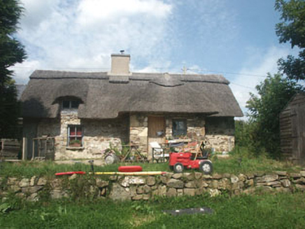 The Old ForgeHouse · 482 ydIndicatedFairy fort / earthen ringfort · 567 yd
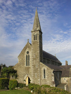 Saint Bridget's Catholic ChurchChurch/chapel · 996 ydRoddenagh WoodForest · 1467 yd(Site of) Castle & RampartCastle, unclassified · 1579 ydSite of CastleCastle, unclassified · 1619 yd1798 Lacey Brothers MemorialMemorial · 2.9 mi
 Croghan KinsellaMountain / peak · 2.9 miCoolalug WoodWood · 3.1 miLuke O'Toole MemorialMemorial · 3.9 mi
 Monalee HillMountain / peak · 4.2 mi
More castles and forts in County Wicklow · All of County Wicklow
What do you know about this place?