What is recorded here
Situated on a low hill. This is a circular flat-topped and grass-covered mound (diam. of top 13m NE-SW; diam. of base 40m NE-SW; H 5.6m at NE to 7m at SW) with some trees that has a fosse (at NE: Wth of top 7m; Wth of base 2m; ext. D 1.1m) which can be distinguished from the base of the mound WSW-N-E. The parish church of Girley (ME023-015----) is c. 300m to the ESE.
From the National Monuments Service (Archaeological Survey of Ireland) record ME023-014
The monument record does not grant public access. Check the route and ask the landowner before entering private land.
- What survives
- Recorded monument
Places near here
Photo credits
- National Inventory of Architectural Heritage
- Kieran Campbell, Geograph · Creative Commons Attribution-ShareAlike 2.0
- Garry Dickinson, Geograph · CC BY-SA 2.0
- Bob Embleton, Geograph · CC BY-SA 2.0
- surrealpenguin, Wikimedia Commons · CC BY-SA 2.0
- Sitomon, Wikimedia Commons · CC BY-SA 2.0
- Mike Searle, Geograph · CC BY-SA 2.0
Causey FarmHeritage attraction · 642 ydFarmaphobiaHeritage attraction · 667 yd Catholic Church of the Immaculate ConceptionChurch/chapel · 1041 ydBoglandMemorial · 1128 ydDrewstown HouseStables · 1.2 miDrewstown LittleMountain / peak · 1.3 miGrave YardGraveyard · 2.6 miCastleCastle, motte · 2.8 miStanding stone in Balnagon UpperStanding stone · 4.4 miPersian Walnut4.4 miEuropean Yew4.5 miFraine CastleCastle, tower house · 4.6 mi
 Catholic Church of the Immaculate ConceptionChurch/chapel · 1041 ydBoglandMemorial · 1128 yd
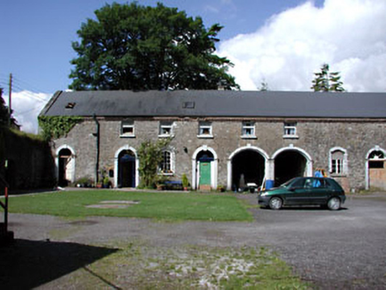 Drewstown HouseStables · 1.2 miDrewstown LittleMountain / peak · 1.3 mi
 Grave YardGraveyard · 2.6 mi
 CastleCastle, motte · 2.8 mi
 Standing stone in Balnagon UpperStanding stone · 4.4 mi
 Persian Walnut4.4 mi
 European Yew4.5 mi
 Fraine CastleCastle, tower house · 4.6 mi
More castles and forts in County Meath · All of County Meath
What do you know about this place?