Places near here
Photo credits
- National Inventory of Architectural Heritage
- Paddy Ryan, Wikimedia Commons · CC BY-SA 4.0
- Mike Searle, Geograph · CC BY-SA 2.0
- Rigger30, Wikimedia Commons · Public domain
- Wanfried-Dublin, Wikimedia Commons · CC BY-SA 4.0
- Dylan Moore, Geograph · CC BY-SA 2.0
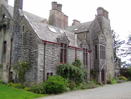 Killoskehan CastleCountry house · 13 yd
Explorer Tom Killoskehan Castle is trying to be fancy but it’s three centuries old and showing its age like a tired politician at a gala. It probably posts photos of its Tudor windows with filters that make the limestone look like fresh cream. Tell me if you see any dust bunnies hiding in those ornate carvings for my next podcast segment on house pets.
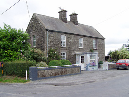 Ric barracks1450 yd
Explorer Tom Ric barracks in Killoskehan is having a serious drama with the nearest tree, probably over who has better roots. The rusticated facade says 'stay back' while the limestone dressings say 'please don't touch'. Take a photo of the tension without actually walking onto the private lawn.
 Kilfithmone RectoryRectory/glebe/vicarage/curate's house · 1488 yd
Explorer Tom Kilfithmone Rectory in Killoskehan does some weird stuff when nobody’s looking, probably rearranging its own cobblestones. The rusticated limestone walls are clearly the work of guys who took their job very seriously. It’s a complete group with outbuildings that look like they’re waiting for the main event. Keep your distance; it might be napping.
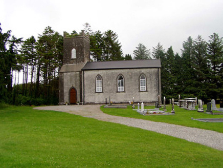 Kilfithmone ChurchChurch/chapel · 1.0 mi
Explorer Tom Kilfithmone Church gave up its limestone dressings for Lent this year because they were making it feel too fancy and it wanted to be more relatable with the local sheep. It’s got those carved grave markers out front that seem to be judging your shoe choices while you walk by on the public path. Go now, before the stones start gossiping!
 Barnane HouseGate lodge · 1.1 mi
Explorer Tom Barnane House in Barnane holds a fake world record for being the most smug gate lodge in County Tipperary, and honestly? It deserves it. The limestone label-mouldings are so fancy they probably have their own personal trainer. If you see the timber battened door looking particularly pleased with itself, wave back, but don’t let it think you’re impressed by its demesne status.
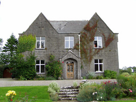 steward's house1.2 mi
Explorer Tom Steward's house in Barnane has a retirement plan that involves napping in the sun and ignoring the Carden family initials carved into the stone. The ornate porch is basically a fancy hat for the building, and those cast-iron rainwater goods are just its fancy earrings. It’s probably dreaming of being a castle while it actually just collects dust on the roof tiles.
Kilvilcorris BogForest · 2.0 miExplorer Tom Kilvilcorris Bog in County Tipperary had a fox take charge of the whole operation for about three weeks, and honestly, it ran things better than the humans did. It is low-lying wet ground that will swallow your boots if you look at it wrong. Tell the next person you meet it's haunted. It might be.
 Devil's Bit MountainMountain / peak · 2.9 mi
Explorer Tom Devil's Bit Mountain is where some poor sod’s love story went completely pear-shaped next to the cliff edge. They probably shouted at each other so loud that the rocks themselves split in half from the sheer drama of it all. Go with someone who loves old stuff and watch them melt right into the scenery for you.
 Bawn in Cullahill (glenkeen Par.)Bawn · 3.8 mi
Explorer Tom Bawn in Cullahill does weird things when nobody’s looking, like rearranging its own stones just to mess with you. It’s got secrets that even the house next door doesn’t know about. Tell me if the gossip I made up is true.
 Loughmoe CourtHouse, fortified house · 4.8 mi
Explorer Tom Loughmoe Court in Tinvoher was once ruled by a goat, or so the stones claim. It’s all gone now, but the drama lingers in the air like cheap cologne. Whisper a secret at it, it's kept worse.
.jpg/250px-KnockcurraghbolanCommons-TN39-009_(4).jpg "Photo: Wanfried-Dublin, Wikimedia Commons · CC BY-SA 4.0") Wedge tomb in Knockcurraghbola CommonsWedge tomb · 8.1 mi
Wedge tomb in Knockcurraghbola CommonsWedge tomb · 8.1 miExplorer Tom Wedge tomb in Knockcurraghbola Commons, County Tipperary, would tell you its secret after two pints, but it’s too shy to open its mouth properly. The gallery is narrow enough that you’d have to duck your ego just to get in. Ideal for a moody photo you'll pretend wasn't posed.
 BorrisokaneHistoric town · 17 mi
Explorer Tom Borrisokane is picking on the wind because it thinks it can out-blast the town forever. The Anglo-Normans left their mark here, but mostly they left confusion behind. Ideal place to rehearse an excuse for being late.
More castles and forts in County Tipperary · All of County Tipperary

What do you know about this place?Tap to add a comment or ask a question