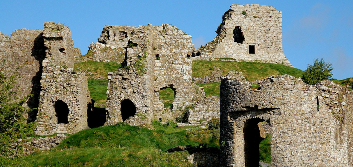
What is recorded here
Part of N wall and NE angle survive of this two-storey high tower house (dims. 7.3m N-S, 8m E-W) which is built of roughly coursed limestone rubble. It has a N-S barrel vault over ground floor, a large ope with a segmental arch on first floor and remains of a corbel to the N, of this, which carried an attic floor. Evidence of the bawn (LA034-019013) (dims. 22m N-S, 27m E-W) to N and S defined by a low bank (Wth. c. 4m) and outer fosse. Numerous earthworks in the field to N, S and W of the castle may be of medieval date. However castle is located on wet marshy land with stream immediately to SE and some of these earthworks may be associated with drainage of the field in which the castle is situated. Evidence of small circular earthwork defined by a scarp (H 0.5m) enclosing the castle at a distance of approx. 10m away from the walls of the castle. More extensive remains of earthworks in field to W of roadway in field between castle and priory (LA034-019003-). Large rectangular shaped earthwork or platform (approx. dims. 20m N-S x 25m E-W) defined by a scarp (0.3m) located 20m to the W of the castle. This earthwork may be related to eighteenth/nineteenth century drainage of this field. Described by Carrigan as ' The broken castle, about 40 perches south of the churchyard (LA034-019005-), probably marks the position of the Grange, or farm house, belonging to the Priory. The castle was perfect, or nearly so, till 1801, when it fell. One of its walls still stands to a height of 20 ft. One small field south of the castle stood the Priory mill, known as the Black Mill. Its modern sucessor was used as a fulling mill, by the present proprietors, till not many years ago (Carrigan 1905 vol. 2, 239)
The above description is derived from the published 'Archaeological Inventory of County Laois' (Dublin Stationery Office, 1995) compiled by P. David Sweetman, Olive Alcock and Bernie Moran. In certain instances the entries have been revised and updated in the light of recent research.
Date of upload: 17 December 2007
A local castle; wider significance not recorded.
The monument record does not grant public access. Check the route and ask the landowner before entering private land.
- What survives
- Recorded monument
Places near here
 Bawn in AghmacartBawn · 44 yd
 Grave YardGraveyard · 215 yd
 Aghmacart Churchchurch/chapel · 229 yd
 Castle and PrioryCastle, unclassified · 249 yd
 Priory (in Ruins)Religious house, Augustinian canons · 254 yd
 Round tower in AghmacartRound tower · 265 yd
 Street fieldArchaeological place · 2.2 mi
 Big WoodWood · 2.5 mi
 Cnoc SeanrathaMemorial · 3.7 mi
 DelaneyMemorial · 5.2 mi
 Anker's IslandIsland · 6.3 mi
 Belmont Househouse · 717 yd
Other information
Photo: Credit not shown in the picture search · Rights wording not checked; contact us if this picture should be removed