What is recorded here
Ballynagarde Castle rose as a four-storey tower around 1550, holding a circular bartizan and staircase turret that watched the road long before modern cars disturbed its stones. The Bourke family claimed it in the seventeenth century, while later owners disputed rooms and stories until the Crokers repaired it into a shape O'Donovan could not recognise in 1840. Its battered base and loop openings remain stark beside the boundary wall, preserving a house that changed hands often but never stopped defending its own identity.
Castle and bawn (LI022-053002-) located in the townland of Williamstown on the 1840 ed. OSi 6-inch map, however shown standing in the townland of Ballynagarde on the revised Cassini OSi 6-inch map. Westropp (1906-7, 90) recorded the following details about Williamstown or Ballywillin Castle and bawn; 'Perhaps Ballywillin C[astle], 1583 (Des. R., 37). 1625 Theo, or Tibbott Bourke, Williamstown C[astle]. except the "Geist Hall" (Inq. Chan., Car. I., 11). 1636 John, his son, held a room in it, with the bawn and a stone house in the north part of the C[astle]. (lb., Car. IL, 180). 1655 Lord Brittas, Dr. T. Arthur, and others claimed the C[astle]. and bawen (C.S., xxi., p. 35). 1666 Granted to Col. Clayton and W. Matthews, except the middle story, confirmed to Dr. Arthur's daughters (Act Sett.). Fabric - Fitzgerald describes it as a tower without outworks (I,p. 297). It was repaired and modernised by the Crokers, so O'Donovan failed to find it in 1840 (O.S.L. 8, pp. 151, 366)'. The 1654-56 Civil Survey of Limerick recorded that Theobald Lord Baron of Brittas, an Irish Papist, was the owner of Williamstown which contained 'a Castle and a Bawen' (Simington 1938, 81).
Described by the National Inventory of Architectural Heritage (NIAH) as a, 'Detached square-plan four-storey tower house with battered base, built c. 1550, with substantial additions in the nineteenth century. Stepped crenellations to battlements with carved limestone chimneystack to north-west corner and circular bartizan to south-east corner. Rubble limestone walls with cut and tooled quoins and cut limestone stringcourse beneath parapet. Square-headed openings with mixed single and paired lights having cut limestone surrounds. Loop openings to north-west corner. Square guardrobe opening to ground floor east elevation. Outbuilding to west of site having pitched corrugated-iron roofs and rubble limestone walls with red brick voussoirs to openings. Dressed limestone boundary wall to front of site with stepped crenellated copings. Square-profile limestone piers with crenellated caps flanking replacement wrought-iron gates' (www.buildingsofireland.ie; NIAH Reg. No. 21902228).
Classified by Donnelly (1999, 22, 31, 37) as a Type 4 tower house which consists of late tower houses and fortified houses of late 16th or 17th century which possess 'architectural features which include tourelles with shot holes, hood-moulded and mullioned windows, parapet water spouts and cruciform roofs'.
Williamstown Castle described by Salter (2004, 97) as follows; 'There is a circular bartizan with gunloops on the SW corner of this tower measuring 9m long by about 7.5m wide lying beside a road, and there is a turret over the staircase in the NW corner. The bartizan and parapet were repaired in the 19th century, when a number of other alterations were made. The fifth storey has two-light windows in the north and south end walls'.
Compiled by: Caimin O'Brien
Date of upload: 4 December 2020
The monument record does not grant public access. Check the route and ask the landowner before entering private land.
- What survives
- Recorded monument
Places near here
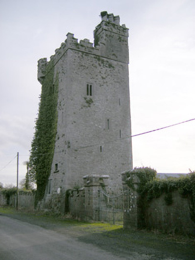 Williamstown Castlecastle/fortified house · 1 yd
 Enclosure in Arywee,carnaneEnclosure · 665 yd
 ToberauillinSpring · 868 yd
 Ballynagarde Ho.Castle, tower house · 1150 yd
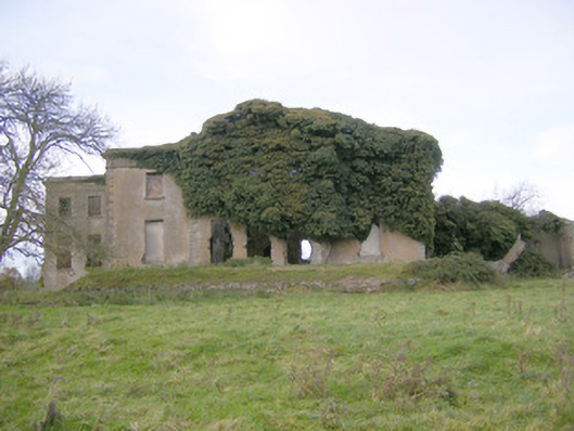 Ballynagarde Housecountry house · 1152 yd
 Rockstown Castle (in ruins)Castle, tower house · 1209 yd
 BarrowBarrow, ring-barrow · 1227 yd
 Carnane RockNamed rock · 1.1 mi
 Skool HillMountain / peak · 1.3 mi
 Banoge's WellSpring · 1.7 mi
 European ashEuropean ash · 4.8 mi
 Monasteranenagh AbbeyHeritage attraction · 5.5 mi