
What is recorded here
From the National Monuments Service (Archaeological Survey of Ireland) record OF038-008
Places near here
Photo credits
- Maker not stated on source page, www.pinterest.com
- Maker not stated on source page, www.irelandhighlights.com
- Maker not stated on source page, en.m.wikipedia.org
- Maker not stated on source page, www.geograph.ie
- Maker not stated on source page, id.pinterest.com
- Maker not stated on source page, pixels.com
- National Inventory of Architectural Heritage
- Maker not stated on source page, www.youtube.com
- Dieglop, Wikimedia Commons · CC BY-SA 4.0
 Fairy fort / stone ringfort in Cloghan (clonlisk By.)Fairy fort / stone ringfort · 1168 yd
Explorer Tom This stone fort in Cloghan would post photos of its own ruins with heavy filters. A road cut through it, so it’s…
 Bullaun stone in KilcolmanBullaun stone · 1565 yd
Explorer Tom Bullaun stone in Kilcolman in County Offaly is stuck next to a stream and a saint. I bet it’s secretly dating the holy…
 Enclosure in Rath MoreEnclosure · 1679 yd
Explorer Tom Enclosure in Rath More is a potential site that vanished so completely you’d need a microscope and a strong drink to…
 Church in Cloghan (clonlisk By.)Church · 1.1 mi
Explorer Tom Church in Cloghan is unlocated, which means it’s playing hard to get from the road. It thinks the tarmac is a personal…
 Bullaun stone in Cloghan (clonlisk By.)Bullaun stone · 1.1 mi
Explorer Tom Bullaun stone in Cloghan is unlocated, meaning it’s playing hide-and-seek with the entire survey team and winning hands…
 Fairy fort / earthen ringfort in SrahanbregaghFairy fort / earthen ringfort · 1.3 mi
Explorer Tom Fairy fort / earthen ringfort in Srahanbregagh has a field boundary made of its own stones, cheeky! The map makers got…
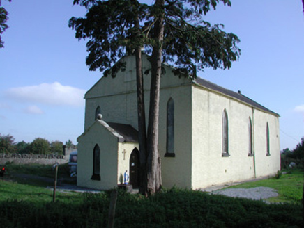 Saint Colman's Church (Kilcolman)Church/chapel · 1.3 mi
Explorer Tom Saint Colman's Church (Kilcolman) is locked in a feud with the hill next door over who has the better view. It's got…
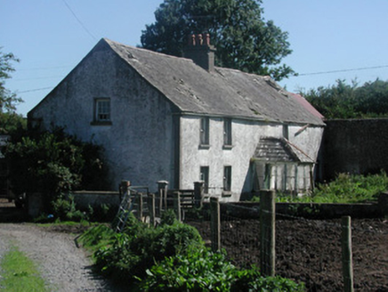 farm house1.3 mi
Explorer Tom Farm house in Dromoyle is derelict but still thinks it has a fan club. It's simple, modest, and probably smells like…
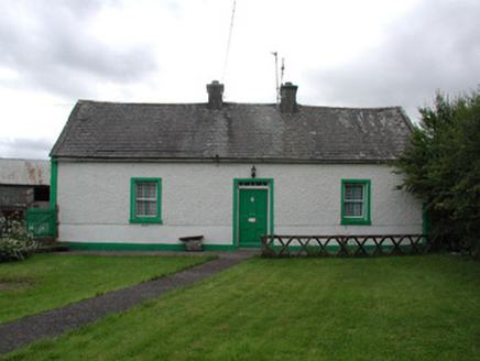 Lisduff CottageHouse · 1.5 mi
Explorer Tom Lisduff Cottage in Lisduff is a small vernacular house that’s surviving against the odds of big houses everywhere else.…
 Rathmore CastleRuins · 1.7 mi
Explorer Tom Rathmore Castle in County Offaly holds a fake world record for being the most ignored ruin on the map. It’s been…
 Rathmore Castle (in Ruins)Bawn · 1.7 mi
Explorer Tom Rathmore Castle, County Offaly, got into a fight with a fairy over parking rights last week. It’s a bawn that thinks…
 Leap CastleGate lodge · 2.2 mi
Explorer Tom Leap Castle gate lodge would tell its replacement that it’s too big and not decorative enough. It’s got Gothic windows…
More archaeology and monuments in County Offaly · All of County Offaly

What do you know about this place?Tap to add a comment or ask a question