
Places near here
Photo credits
- National Inventory of Architectural Heritage
- kevin higgins, Geograph · CC BY-SA 2.0
- kevin higgins, Wikimedia Commons · CC BY-SA 2.0
- Colin Park, Geograph · CC BY-SA 2.0
- Rwxrwxrwx at English Wikipedia, Wikimedia Commons · Public domain
- Kevin O'Brien 13, Wikimedia Commons · CC BY-SA 4.0
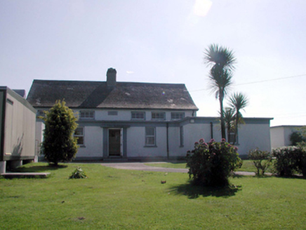 Kilbrien National SchoolOfficially recorded historic building · 1.4 mi
Explorer Tom Kilbrien National School in Kilbryan Lower has a tall tale about a hidden tunnel leading straight to the local pub. Teachers swore they could hear pints clinking during maths class, but the kids just called them lazy. Listen closely for any clink of glasses next time!
 SeefinMountain / peak · 1.4 mi
Explorer Tom Seefin is where the rabbits go to judge your outfit and your life choices without saying a word. They look at your boots with such disappointment that you’ll want to change them immediately on the spot. Pretend it's yours and plan the housewarming.
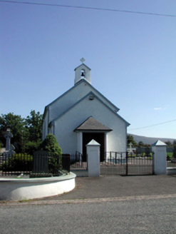 Saint Patrick's Catholic ChurchChurch/chapel · 1.4 mi
Explorer Tom Saint Patrick's Catholic Church in Kilbryan Lower seems to have wandered in from the wrong county entirely. It’s got that look of a chap who took a wrong turn and just decided to stay put. Tell the locals I said it needs a new hat, not a new history.
 Standing StoneRuins · 1.5 mi
Explorer Tom This unnamed Standing Stone is haunted by a ghost who is far too lazy to actually do anything, so he just stands there looking confused. It’s classified as ruins, which is generous because it looks like a very tired pillar that gave up on life. Perfect detour when the satnav has a meltdown.
 CoumfeaMountain / peak · 3.6 mi
Explorer Tom Coumfea was allegedly designed by a particularly stubborn mother-in-law who wanted a view of her son’s house but not the neighbor's garden. It’s a very specific architectural choice for a mountain, really. Great spot to propose. Or at least to propose lunch.
 Mahon ValleyCliff · 4.0 mi
Explorer Tom Mahon Valley witnessed a love story that went badly wrong because one partner brought a sausage roll. The other one got jealous of the bread, and now they both live there. Best seen with a hangover and a sausage roll.
 Mahon FallsWaterfall · 4.0 mi
Explorer Tom Mahon Falls is supposedly the escape route used by a local chieftain who fled his creditors in a canoe. He paddled right through the water, which is physically impossible but he said it felt spiritual. If anyone asks, Tom sent you.
Bawn in BarnankileBawn · 4.1 miExplorer Tom Bawn in Barnankile is run by a dog who hasn't seen a real person since 1654. It was fortified for a big house, but now it’s just ghosts and bad memories of walls. Practise your Irish on it, it won't correct you.
Siglloges LoopWalking route · 4.4 miExplorer Tom Siglloges Loop would tell its younger self to stop trying so hard and just enjoy the fact that nobody can pronounce its name correctly on the first go. It’s got a bit of a cheek about it, looping back on itself like a cat chasing its tail but with much more dignity involved. Dare you to say hello to it out loud.
Site of CastleCastle, unclassified · 4.7 miExplorer Tom Site of Castle in Castlereagh would describe itself to a stranger as a ‘conceptual structure’ that got destroyed by Cromwell before it could fully commit. It’s just a fork in the lane now, but it remembers being a nice place for John Power of Dunhill to hang out. Wave at the cows, they're the real locals.
 CoumshingaunMountain corrie and lake · 5.5 mi
Explorer Tom Coumshingaun is the result of two lads betting in a pub that they could dig a lake big enough to drown their bad luck. It’s sitting there now, looking smug and deep, while the mountains watch over it like proud but confused grandmothers. Tell me if the gossip I made up is true.
More mountains and hills in County Waterford · All of County Waterford

What do you know about this place?Tap to add a comment or ask a question