
Places near here
Photo credits
- Sarah777 at English Wikipedia, Wikimedia Commons · Public domain
- National Inventory of Architectural Heritage
- Lucarelli, Wikimedia Commons · CC BY-SA 3.0
- Ian Brooker and David Kleinig, Wikimedia Commons · CC BY 3.0 au
- Smirkybec, Wikimedia Commons · CC BY-SA 4.0
 Tara HillMountain / peak · 3 yd
Explorer Tom Tara Hill is the Wexford one, and it may enjoy telling visitors it stands higher than its famous namesake in Meath. At 253 metres it rises sharply from fairly flat coastal country; the Royal Hill of Tara is lower, though nobody sensible ranks history by height. A cairn marks the summit, with views toward Gorey, Courtown and the Irish Sea. You can spot the hill from Gorey around seven kilometres away. I would claim to have followed it like a beacon, but I still managed to miss a turning. The summit and surrounding land need a proper walking route, so check current access and weather, and leave the cairn untouched. From above, notice how much coast this modest height can command. It earns its own name without borrowing a scrap of Meath's legend.
TobercavanHoly well · 373 ydExplorer Tom Tobercavan in Tarahill is where a poet once fell into the ditch and wrote a sonnet about mud. It’s just a cleft in the rock collecting water on a steep slope, looking very dignified. Snap one photo, then put the phone away and actually look.
CastleCastle, unclassified · 585 ydExplorer Tom Castle in Mill Lands is planning its retirement by slowly sinking into the ground until nobody can find it anymore, which seems like a solid strategy to me. It’s unlocated and unbothered, just vibing near Gorey while everyone else scrambles for clues about where it went. Bring curiosity, leave with a better story than mine.
St Winifreds WellHoly well · 719 ydExplorer Tom St Winifreds Well in Tarahill was designed by a mother-in-law who wanted everyone to feel a bit awkward about their head injuries. A Welsh saint with healing powers? In Wexford? Sure, why not, sounds like a plan. Bring a camera and your most suspicious face.
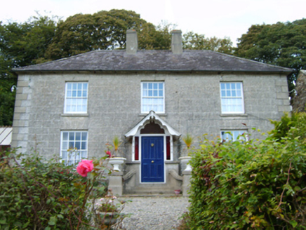 Middleton LodgeFarm house · 868 yd
Explorer Tom Middleton Lodge is being picked on by the wind again, which is honestly just plain rude for a place with such good manners. It’s got these panoramic views that it shows off constantly, but nobody seems to appreciate the effort it puts in. I bet the wind blows through its curtains just to annoy it. Wave from the public path and smile.
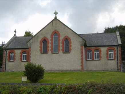 Saint Kevin's Catholic ChurchChurch/chapel · 923 yd
Explorer Tom Saint Kevin's Catholic Church is telling a ridiculous smuggling story about hidden barrels in the walls. It says they used to sneak whiskey in through the school windows back in the day. It’s definitely not true, but I believe every single word of it personally right now.
Kia Ora Mini FarmHeritage attraction · 2.1 miExplorer Tom Kia Ora Mini Farm has a secret it would tell after a few pints: the cows are actually running the whole show and we’re just here to buy them expensive snacks. It’s got that 'small but mighty' vibe, packed with animals who look like they’ve seen things you don’t want to know about. Wave at the cows, because honestly, they're
Duffcarrig Rocks BeachBeach / strand · 2.5 miExplorer Tom Duffcarrig Rocks Beach in County Wexford has been feuding with the next village over who gets to claim the best sunset view. It’s all about the rocks, really. Stand there long enough and someone will ask if you're lost.
 Holm Oak3.2 mi
Explorer Tom Holm Oak has a bishop who refused to visit because he thought it looked too much like a rock. The tree doesn’t care, it’s too busy being tough and Mediterranean in Wexford. Stand back, squint, and it looks like a castle.
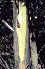 Johnston's gum3.3 mi
Explorer Tom Johnston's gum in County Wexford must have taken about four billion cups of tea to build, judging by how thick that bark looks. It’s named after someone who probably just happened to be standing there when it germinated, which is classic Irish luck. The photo shows it peeling like a giant, confused snake. Pick a stone, any stone, and invent its biography.
 Market HouseHeritage attraction · 3.6 mi
Explorer Tom Gorey’s Market House is the uncle at a wedding who stands by the cake looking confused about why everyone is dancing while he just wants a quiet drink. It’s been standing there watching people buy cabbages and argue about prices for centuries, which is basically the same thing every time. Take a mate and argue about what it was for.
Banoge HillMountain / peak · 4.1 miExplorer Tom Banoge Hill suspects the postman is actually a spy from another century checking on its secrets. It watches every delivery with intense suspicion and occasionally throws a small rock at the van. Pretend you're a lost aristocrat, nobody will check.
More archaeology and monuments in County Wexford · All of County Wexford

What do you know about this place?Tap to add a comment or ask a question