What is recorded here
Marked only on the 1940 ed. of the OS 6-inch map where it is described as St. Winifred's Well, defived from local sources (OSFM). This 7th century Welsh saint is associated with the healing power of springs and her feastday is celebrated on the 2nd of November (http://en.wikipedia.org/wiki/Winefride). The well is located towards the bottom of the steep N-facing slope of Tara Hill where a gentler slope begins. This is a natural spring with no evidence of veneration. The parish church of Kilcavan (WX007-010001-) is c. 200m to the N.
Marked only on the 1940 ed. of the OS 6-inch map where it is described as St. Winifred's Well, defived from local sources (OSFM). This 7th century Welsh saint is associated with the healing power of springs and her feastday is celebrated on the 2nd of November (http://en.wikipedia.org/wiki/Winefride). The well is located towards the bottom of the steep N-facing slope of Tara Hill where a gentler slope begins.…
From the National Monuments Service (Archaeological Survey of Ireland) record WX007-013
The monument record does not grant public access. Check the route and ask the landowner before entering private land.
- What survives
- Recorded monument
Places near here
Photo credits
- National Inventory of Architectural Heritage
- Sarah777 at English Wikipedia, Wikimedia Commons · Public domain
- Ian Brooker and David Kleinig, Wikimedia Commons · CC BY 3.0 au
- Lucarelli, Wikimedia Commons · CC BY-SA 3.0
- Smirkybec, Wikimedia Commons · CC BY-SA 4.0
- Ryanforsyth9, Wikimedia Commons · CC BY-SA 4.0
- Jonathan Billinger, Wikimedia Commons · CC BY-SA 2.0
CastleCastle, unclassified · 340 yd water pump515 ydSaint Kevin's Catholic ChurchChurch/chapel · 517 ydTara HillMountain / peak · 717 ydTobercavanHoly well · 1033 ydEmbanked enclosureFairy fort / earthen ringfort · 1.0 miKia Ora Mini FarmHeritage attraction · 2.4 miJohnston's gum3.2 miHolm Oak3.6 miMarket HouseHeritage attraction · 3.8 mi1798 MonumentMemorial · 4.2 miMonalee HillMountain / peak · 6.8 mi
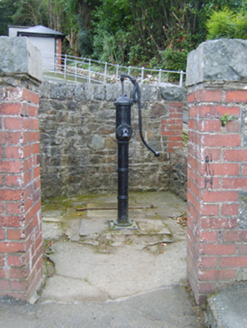 water pump515 yd
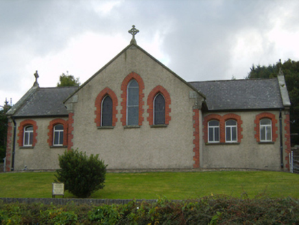 Saint Kevin's Catholic ChurchChurch/chapel · 517 yd
 Tara HillMountain / peak · 717 ydTobercavanHoly well · 1033 ydEmbanked enclosureFairy fort / earthen ringfort · 1.0 miKia Ora Mini FarmHeritage attraction · 2.4 mi
 Johnston's gum3.2 mi
 Holm Oak3.6 mi
 Market HouseHeritage attraction · 3.8 mi
 1798 MonumentMemorial · 4.2 mi
 Monalee HillMountain / peak · 6.8 mi
More archaeology and monuments in County Wexford · All of County Wexford
What do you know about this place?