What is recorded here
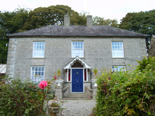
Detached three-bay two-storey double-pile farmhouse, extant 1829, on a square plan centred on single-bay single-storey gabled advanced porch to ground floor. Occupied, 1901. Vacant, 1911. Sold, 1931. Hipped double-pile (M-profile) slate roof with lichen-spotted clay ridge tiles, paired rendered red brick Running bond central chimney stacks having stepped capping, and cast-iron rainwater goods on slate flagged eaves retaining cast-iron downpipes. Rusticated wall to front (east) elevation on rendered plinth with rusticated rendered quoins to ends; rendered, ruled and lined surface finish (remainder). Hipped square-headed central door opening approached by flight of three concrete steps with chamfered timber mullions supporting chamfered timber transom framing timber panelled door having sidelights. Square-headed window openings with cut-granite sills, and rusticated voussoirs framing eight-over-eight timber sash windows with two-over-two timber sash windows to rear (west) elevation. Set in landscaped grounds on a slightly elevated site with roughcast piers to perimeter having stepped capping supporting looped wrought iron gate.
A farmhouse representing an integral component of the domestic built heritage of north County Wexford with the architectural value of the composition suggested by such attributes as the deliberate alignment maximising on panoramic vistas overlooking a rolling landscape; the compact plan form centred on an expressed porch demonstrating good quality workmanship; and the diminishing in scale of the openings on each floor producing a graduated visual impression. Having been well maintained, the elementary form and massing survive intact together with substantial quantities of the historic or original fabric, both to the exterior and to the interior, thus upholding the character or integrity of the composition. Furthermore, adjacent outbuildings (extant 1840) continue to contribute positively to the group and setting values of a self-contained ensemble having historic connections with the Middleton family including William Middleton (d. 1895; Calendars of Wills and Administrations 1895, 522) and Maria Middleton (d. 1909; Calendars of Wills and Administrations 1910, 384).
From the Buildings of Ireland (National Inventory of Architectural Heritage) record 15700729
This does not grant access. Most recorded buildings are privately owned; view them only from public ground unless the owner allows entry.
Places near here
Photo credits
- Sarah777 at English Wikipedia, Wikimedia Commons · Public domain
- National Inventory of Architectural Heritage
- Lucarelli, Wikimedia Commons · CC BY-SA 3.0
- Smirkybec, Wikimedia Commons · CC BY-SA 4.0
- Ian Brooker and David Kleinig, Wikimedia Commons · CC BY 3.0 au
- Ryanforsyth9, Wikimedia Commons · CC BY-SA 4.0
TobercavanHoly well · 496 yd Tara HillMountain / peak · 871 ydCopseFairy fort / earthen ringfort · 1406 ydSaint Kevin's Catholic ChurchChurch/chapel · 1435 ydCastleCastle, unclassified · 1446 ydwater pump1459 ydKia Ora Mini FarmHeritage attraction · 2.1 miDuffcarrig Rocks BeachBeach / strand · 2.1 miHolm Oak2.9 miMarket HouseHeritage attraction · 3.7 miJohnston's gum3.8 mi1798 MonumentMemorial · 4.1 mi
 Tara HillMountain / peak · 871 ydCopseFairy fort / earthen ringfort · 1406 yd
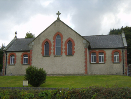 Saint Kevin's Catholic ChurchChurch/chapel · 1435 ydCastleCastle, unclassified · 1446 yd
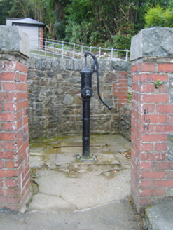 water pump1459 ydKia Ora Mini FarmHeritage attraction · 2.1 miDuffcarrig Rocks BeachBeach / strand · 2.1 mi
 Holm Oak2.9 mi
 Market HouseHeritage attraction · 3.7 mi
 Johnston's gum3.8 mi
 1798 MonumentMemorial · 4.1 mi
More historic places in County Wexford · All of County Wexford
What do you know about this place?