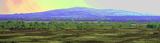
This site is a hilltop prehistoric burial mound (H 3.75m; top diam. 4m; base diam. 21m) standing on the summit of Croghan Hill, with panoramic views of the surrounding landscape. This extinct volcano and prominent landscape feature in NE Offaly stands 4km SE of the boundary with County Westmeath. In the mythology of Ireland this hill was called Brí Éile named after Éile, daughter of Eochaidh Feidhleach, king of Ireland, who divided the country into five provinces and their respective provincial kings (O’Donovan 1856, 87-8, 148). The burial mound stands in the Gaelic territory of Uí Failghe (Offaly) ruled by the O’Connor clan in the province of Leinster close to the provincial border with Meath. According to O’Donovan this burial mound was the ‘monument of Congal’ mentioned in the ‘Laoidh na Leacht’ or ‘Poem of the Monuments’ (Herity 2008, 42). Congal Cáech was king of the Dál nAraidi in Ulster and ally of the Clann Cholmáin of Westmeath. He was killed at the battle of Mag Rath in the year 637 AD. Nearby monuments include Glenmore Holy Wells or St. Patricks Well (
OF010-004006-/007-) which lies 460m to the NNE. A possible fifth century church site (
OF010-004002-), known locally as ‘Bishop Mac Caille’s Church’, lies 150m to the E on the shoulder of Croghan Hill. The deserted medieval village (
OF010-010001-) of Croghan, Croghan Church (
OF010-010006-) and castle (
OF010-010003-), the residence of the O’Connor clan and a medieval road known as ‘The Togher of Croghan’ stands clustered together 920m to the WSW of the hilltop. In 1997 a small burial ground was partially excavated by Dominic Delany in a field 510m SSW of Croghan Hill and N of Cannakill School. This burial ground was located between two holy wells (
OF010-011-/012---). The burial mound is annotated as a ‘Carn’ on the 1838 edition of the Ordnance Survey [OS] 6-inch map, however there is no stone material visible on the grass-covered mound and no evidence of any stone kerbing around the base of the monument. A trig point was constructed by the OS on the summit of the mound which marks the height 769 feet [234m] above sea level. The burial mound on top of Croghan Hill is a prominent landmark in the landscape of the region which is exaggerated by the low-lying nature of the surrounding countryside. In 1838 John O’Donovan described the hilltop setting and the extensive views from the mound when he wrote; ‘you can survey at a glance the Clár or level plain of Ofalia and its natural boundaries. It stretches, nearly as level as a lake southwards to the foot of the Slieve Bloom mountain [27km SW], and to the Sugar Loaf hills at Killowen [Killone 32km], in the Queen’s County [Laois], and eastwards to the hill of Allen [30km SE] in the county of Kildare. I never enjoyed a finer prospect than that commanded by this hill, which may be called O’Connor Faly’s Carn’ (Herity 2008, 43). The plain at the foot of Croghan Hill was described in the Irish annals as ‘Magh- Dairbhreach’ or the ‘Plain of the Oaks’ (O’Donovan 1856, 36). The prehistoric mound which presumably covered a grave or graves although not necessarily so consists of a small gently sloping flat-topped earthen mound with the remains of a shallow fosse encircling the base. Around the base of the mound there are traces of a berm or step which appears to be artificial and could have been caused by grazing livestock. The summit of the monument was damaged by sappers when they were building the trig point in the 19th century (Herity 2008, 43). The earthen mound with enclosing fosse suggests that this monument may be the remains of a bowl-barrow possibly dating from the Bronze Age. Alternatively the mound may cover the remains of a megalithic tomb or a large cist like structure such as a Linkardstown type cist. It is also possible that the mound may be a multi-period monument covering multiple cists inserted over several centuries. In 1974 it was suggested the grass-covered hilltop mound could have covered the remains of a passage tomb even though it was not a type of tomb found in this region (Herity 1974, 261). However this site was not listed as a possible passage tomb in the Survey of Megalithic Tombs of Ireland carried out in 1972. In 2005 it was suggested that the mound represented the remains of a Neolithic cairn possibly covering a passage tomb dating from the period 3500 BC – 2500 BC (Rohan 2005, 24). Further archaeological research on the mound will be required in order to ascertain whether there is any validity to these suggestions. The lack of any kerb stones around the edge of the mound along with the presence of a berm with enclosing fosse would argue against the cairn classification for this monument. Based solely on surface inspection the visible features or morphology of the earthwork would argue for a bowl-barrow classification, although it is possible that it may be the remains of a sod-covered cairn. The evidence for the existence of such a hillfort is uncertain and requires more fieldwork and survey in order to confirm the existence of such a monument on Croghan Hill. It is possible that the burial mound stood inside a small hilltop-enclosure the partial outline of which is visible on various aerial photographs (CUCAP APH070/071; Digital Globe). Oblique aerial photographs taken in July 1966 suggest the possibility that the natural slope of the hill was used to define the hilltop edge from E to S with a possible double bank and intervening fosse defining the remaining area best visible to the N of the burial mound. A linear feature running E-W consisting of a possible double bank with intervening fosse can be clearly seen 17m N of the mound on Google Earth aerial photography (2003). This earthwork combined with the natural slope of the hill which may have been artificially enhanced in places may be the remains of a hilltop enclosure (approx. int. dims. 65m N-S x 58m E-W). Post-medieval cultivation ridges roughly running E-W across the hillslope are visible on aerial photographs. A meandering low earthen bank visible on aerial photographs 126m N and 315m E of the burial mound could be the remains of a larger enclosure, possibly indicating the existence of a rampart belonging to a hillfort. This earthwork follows the contour line marking 600 ft. OD on the OS 6-inch map. However the meandering nature of the bank and the lack of an enclosing element on the S and W sides of the hill may suggest that it is the remains of a prehistoric field system rather than the rampart of a hillfort. The curving section of this earthwork to the E of Bishop Mac Caille’s Church and graveyard marks the boundary between the parishes of Croghan and Ballyburly. The burial mound on Cruacháin Brí Éile was reputedly used as the inauguration site for the rulers of this region, the Ó Conchobhair (O’Connor) of Uí Failge (Faly/Offaly) (Fitzpatrick 2004, 32). This ritual function may be an example of a prehistoric burial mound being re-used in the medieval period by the local Gaelic clan. Through the inauguration process the O’Connor family could legitimately rule over this territory by establishing an ancestral link with the prehistoric people buried beneath the mound of Cruacháin Brí Éile. Compiled and revised by: Caimin O'Brien
Date of upload/revision: 18 September 2018

 Croghan HillMountain / peak · 4 ydSite of Bp. MacCailles ChurchChurch · 186 yd
 post box681 yd
 Saint Brigid's Catholic ChurchChurch/chapel · 1577 yd
 Downan Grave YardGraveyard · 4.6 mi

What do you know about this place?Tap to add a comment or ask a question