
What is recorded here
Stone has disappeared and local informant said it was buried in the ground nearby the original site. Not visible at ground level. According to local information the stone was buried in the field it was located in. Located in well drained pasture on NE facing slope of rising ground with nearby standing stone to SW…
Read the whole record
From the National Monuments Service (Archaeological Survey of Ireland) record OF010-015
Places near here
Photo credits
- National Inventory of Architectural Heritage
- Maker not stated on source page, www.neverstoptraveling.com
- Maker not stated on source page, northernantiquarian.forumotion.net
- Maker not stated on source page, nl.pinterest.com
- Maker not stated on source page, en.wikipedia.org
- Sarah777 at en.wikipedia, Wikimedia Commons · Public domain
- Maker not stated on source page, www.pinterest.com
- Maker not stated on source page, www.flickr.com
- Maker not stated on source page, ca.pinterest.com
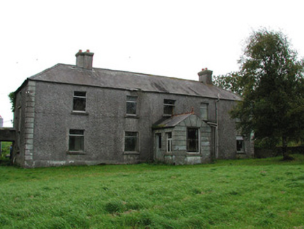 Barrysbrook HouseFarm house · 413 yd
Explorer Tom Barrysbrook House in Barrysbrook, County Offaly: It’s secretly proud of one specific potato that grew through its porch…
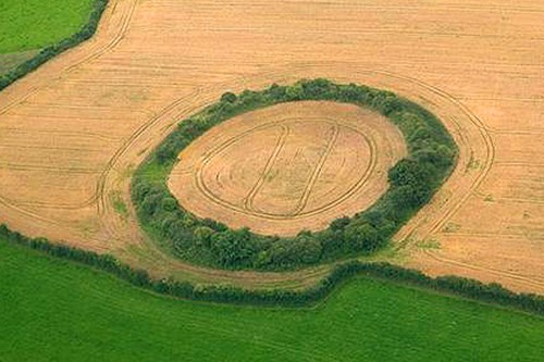 Fairy fort / earthen ringfort in BarrysbrookFairy fort / earthen ringfort · 615 yd
Explorer Tom Fairy fort in Barrysbrook is low-lying and subcircular, which means it basically lives in a puddle most of the time and…
 Stone head in Croghan DemesneStone head · 1101 yd
Explorer Tom Stone head in Croghan Demesne is wearing chain mail like it’s a casual Friday outfit. A love story went wrong right…
 Inscribed stone in Croghan DemesneInscribed stone · 1107 yd
Explorer Tom Inscribed stone in Croghan Demesne holds a fake world record for looking grumpy from an outhouse wall. It’s a carved…
 Bishop Mac Caille's GraveyardGraveyard · 1218 yd
Explorer Tom Bishop Mac Caille's Graveyard in County Offaly has a superstition that if you touch the headstone and blink twice…
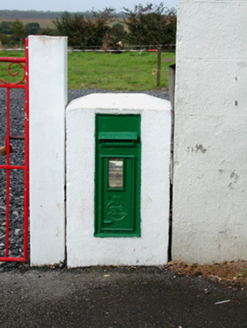 post box1406 yd
Explorer Tom Post box in Croghan Demesne has a local who swears he invented the idea of putting mail in metal cylinders. It bears…
 Glenmore Holy WellsHoly well · 1410 yd
Explorer Tom Glenmore Holy Wells: the matchmaker who worked there must have had a lot of free time. It’s located near St. Patrick's…
 Croghan HillMountain / peak · 1418 yd
Explorer Tom Croghan Hill is only 234 metres high, yet it rises out of Offaly's flat bogland like it has won an argument with the…
 Croghans, St BrigidsGAA ground · 1577 yd
 CastleCastle, unclassified · 3.8 mi
Explorer Tom Castle in Fahy is unlocated, which means it’s playing hard to get with the surveyors. It had a name back in 1838, but…
Ballyburly Old GraveyardGraveyard · 4.0 miExplorer Tom Ballyburly Old Graveyard in County Offaly is where the shortcut that isn’t a shortcut leads you to a dead end full of…
 Black Castle (in ruins)Castle, tower house · 5.3 mi
Explorer Tom Black Castle in Ballyheashill was nearly sold to a farmer for a horse. It has almost no windows, which saves on heating…
More archaeology and monuments in County Offaly · All of County Offaly

What do you know about this place?Tap to add a comment or ask a question