
Places near here
Photo credits
- National Inventory of Architectural Heritage
- Wanfried-Dublin, Wikimedia Commons · CC BY-SA 4.0
- 2ManyCats4Me, Wikimedia Commons · CC0
- Granard Motte.png : Smcq Derivative work: Hogweard, Wikimedia Commons · CC BY-SA 3.0
Explorer Tom Muckram Fort is big enough to hold a scandal, probably involving a lost ring or a secret affair. There’s a possible underground passage that I’m sure leads to the treasure. Stand back, squint, and it looks like a castle.
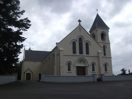 Our Lady of Lourdes Roman Catholic ChurchChurch/chapel · 1725 yd
Explorer Tom Our Lady of Lourdes in Mullaghoran has pink granite columns and stained glass that’s basically a disco ball for angels. It’s Spanish-Romanesque fancy, which means it takes itself very seriously. It's free to admire from afar, don't touch the glass!
DrumbrucklisMountain / peak · 1.2 miExplorer Tom Linked to Drumbrollisk Townland, Drumbrucklis is a Cavan peak where the name sounds like it’s trying very hard to whisper secrets.
IndicatedCastle, unclassified · 1.5 miExplorer Tom Castle in Dundavan was an O'Reilly stronghold, now just a ruined house on top of its ghost. The castle refuses to fall down completely, keeping one last grudge alive. Stand back, squint, and it looks like a castle.
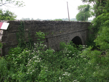 bridge1.8 mi
Explorer Tom Bridge in Drumbannow is cursed to make you wave if you don’t want bad luck, which is stupid because who has time for that? It’s an early nineteenth-century bridge showing off its cutwaters like it’s a swimmer. Twirl your finger and walk on by without looking back.
Aghakilmore LowerMountain / peak · 1.9 miExplorer Tom Aghakilmore Lower is a mountain peak in County Cavan that could be a great spot for a picnic.
Moynagh Upper ForestForest · 2.6 miExplorer Tom Moynagh Upper Forest in County Cavan sounds like a place where the clouds hang low and the views are high.
Carrick RockWood · 3.4 miExplorer Tom Carrick Rock is a wood, and I suspect it’s named after a big boulder that refuses to move.
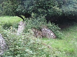 Portal tomb in CarrickacroyPortal tomb · 5.0 mi
Explorer Tom This Portal tomb in Carrickacroy is a small chamber entered from the north. Its entrance was formed by two portal-stones with a sill between them, quite a neat arrangement.
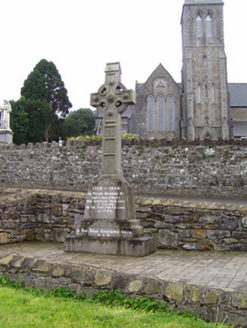 1798 MonumentMonument · 5.9 mi
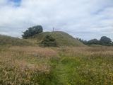 Granard MotteMotte-and-bailey castle remains · 5.9 mi
Explorer Tom Granard Motte would describe the 1800s to a teenager as 'basically a long queue for nothing'. It's just a big mound pretending it remembers something important from the castle days. Spot the oldest stone and give it a name.
 Moat of GranardCastle, motte and bailey · 6.0 mi
Explorer Tom The local sheep at Granard Moat rate it a solid four stars for grass quality. Richard de Tuit built it in 1199 to fight rebels, but now it’s mostly a nap zone. Stand back, squint, and it looks like a castle.
More archaeology and monuments in County Cavan · All of County Cavan

What do you know about this place?Tap to add a comment or ask a question