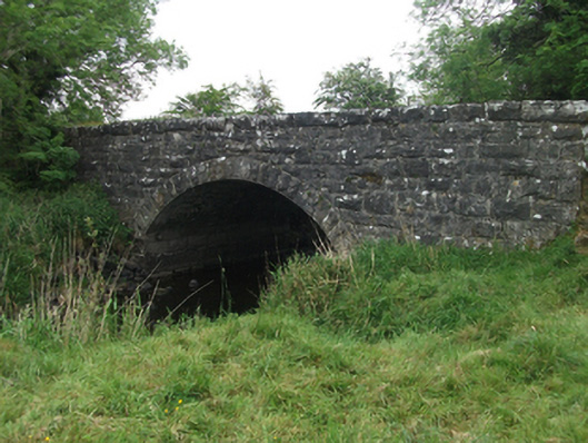
What is recorded here
Single-span segmental-arched limestone road bridge, built c.1850, spanning north-west to south-east over River Erne. Random-coursed squared rock-faced spandrels, parapet and coping. Regular rock-faced voussoirs to arch ring with dressed underside and arris, squared rubble barrel over abutment of larger squared rubble stone. Short flight of rubble and concrete steps to river bank at south-east.
A good example of a modest rural nineteenth century bridge, which contributes to the wider civil engineering heritage of the county, demonstrating the high quality of design and construction employed in that period. Well-executed details including the sharply detailed arch ring enhance the modest architectural design. The use of rock-faced stone is particularly suited to a rural setting and the rock-faced road parapet makes a strong contribution to the historic rural environment. The bridge is evidence of the development of the road network in the area and thereby contributes to understanding the social and economic history of the county.
From the Buildings of Ireland (National Inventory of Architectural Heritage) record 40403701
This does not grant access. Most recorded buildings are privately owned; view them only from public ground unless the owner allows entry.
Places near here
Photo credits
- National Inventory of Architectural Heritage
Carnagh LowerMountain / peak · 344 ydDrumhawnaghMountain / peak · 1274 yd Drumhawnagh StationGoods shed · 1374 ydbridge1629 ydEnclosure in KillycatronEnclosure · 1.0 miEnclosure in Carnagh UpperEnclosure · 1.1 miCornamucklagh WoodlandWood · 2.2 miIndicatedCastle, unclassified · 2.3 miOghill Bog WoodWood · 2.7 miScrabby IslandIslet · 2.9 miCloone HouseCastle, unclassified · 3.2 miRed IslandIslet · 3.5 mi
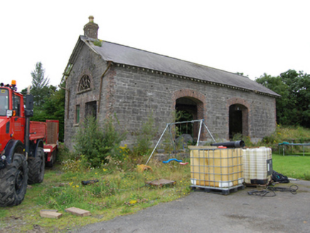 Drumhawnagh StationGoods shed · 1374 yd
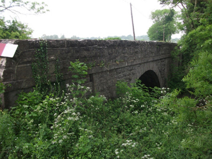 bridge1629 ydEnclosure in KillycatronEnclosure · 1.0 miEnclosure in Carnagh UpperEnclosure · 1.1 miCornamucklagh WoodlandWood · 2.2 miIndicatedCastle, unclassified · 2.3 miOghill Bog WoodWood · 2.7 miScrabby IslandIslet · 2.9 miCloone HouseCastle, unclassified · 3.2 miRed IslandIslet · 3.5 mi
More historic places in County Cavan · All of County Cavan
What do you know about this place?