
What is recorded here
Located at the top of a prominent drumlin, with a N-S section of the River Shannon c. 300m to the W. A rectangular hachured feature is designated as 'Caldragh', which is the Irish word for burial ground, only on the 1945 revision of the OS 6-inch map. This is a grass-covered rectangular platform (dims c. 80m NW-SE c.…
Read the whole record
From the National Monuments Service (Archaeological Survey of Ireland) record LE031-039
Places near here
Photo credits
- Maker not stated on source page, www.pinterest.com
- Maker not stated on source page, eoceanic.com
- Maker not stated on source page, irisharchaeology.org
- Maker not stated on source page, www.flickr.com
- Kmcnamee, Wikimedia Commons · CC BY-SA 4.0
- Brendan Moran / Sportsfile, www.irishexaminer.com
- National Inventory of Architectural Heritage
- Maker not stated on source page, commons.wikimedia.org
- Maker not stated on source page, yandex.ru
- Maker not stated on source page, nl.findagrave.com
 Church in AttiroryChurch · 7 yd
Explorer Tom Church in Attirory is perched on a drumlin like a goat that refuses to move. I swear a local goat once ruled this place…
 Bullaun stone in AttiroryBullaun stone · 23 yd
Explorer Tom A single basin on this Attirory stone hides a treasure that is definitely just an old biscuit tin. It was buried under…
 Fairy fort / earthen ringfort in LisseeghanFairy fort / earthen ringfort · 873 yd
Explorer Tom The wind keeps picking on Lisseeghan because it can’t find the entrance and is getting annoyed. It’s just a grassy…
 Fairy fort / earthen ringfort in CorreenFairy fort / earthen ringfort · 1056 yd
Explorer Tom Fairy fort / earthen ringfort in Correen was built on a bargain where the builder forgot to include breakfast. The…
 Pairc Naoimh Mhuire, St. Mary's GAA, KiltoghertGAA ground · 1056 yd
 Páirc Seán Mac DiarmadaGAA ground · 1078 yd
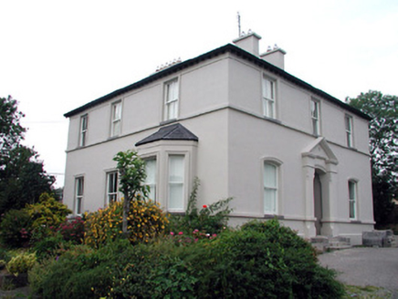 The RectoryRectory/glebe/vicarage/curate's house · 1203 yd
Explorer Tom The Rectory in Townparks has a retirement plan involving very fancy tiles and stained glass windows that hurt to look…
 Fairy fort / ringfort in TownparksFairy fort / ringfort · 1213 yd
Explorer Tom This Townparks ringfort holds a fake world record for being completely invisible under a housing estate. It’s basically…
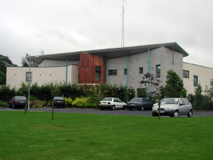 Carrick-on-Shannon CourthouseCourt house · 1304 yd
Explorer Tom Carrick-on-Shannon Courthouse is a modern art piece that thinks it’s a serious government building. The rabbits in the…
 Fairy fort / earthen ringfort in Drumkeeran (leitrim By., Carrick-On-Shannon Ed)Fairy fort / earthen ringfort · 1305 yd
Explorer Tom Fairy fort / earthen ringfort in Drumkeeran makes a deep, resonant humming sound at night that locals claim is just the…
 Bush Hotel GardenGarden · 1499 yd
Explorer Tom The Bush Hotel Garden hears everything through its walls because it’s basically an eavesdropper with roots. It knows…
 Mapped graveyardGraveyard · 1681 yd
Explorer Tom If this Mapped graveyard in County Leitrim could talk, it’d probably tell you it’s the most understated celebrity in…
More archaeology and monuments in County Leitrim · All of County Leitrim

What do you know about this place?Tap to add a comment or ask a question