
Places near here
Photo credits
- Eric Jones, Geograph · Creative Commons Attribution-ShareAlike 2.0
- Eric Jones, Wikimedia Commons · CC BY-SA 2.0
- National Inventory of Architectural Heritage
- Eric Jones, Geograph · CC BY-SA 2.0
- David Crozier, Wikimedia Commons · CC BY-SA 2.0
- HENRY CLARK, Geograph · CC BY-SA 2.0
- Kmcnamee, Wikimedia Commons · CC BY-SA 4.0
 Crannog in lisleitrim lough in Kiltybane or LisleitrimCrannog in Lisleitrim Lough · 1.2 mi
Explorer Tom Crannog in Lisleitrim lough in Kiltybane Or Lisleitrim is an unusually large wooded crannog, which means it’s basically…
 Lisleitrim FortArchaeological place · 1.5 mi
Explorer Tom Lisleitrim Fort in County Armagh is playing hard to get, claiming it was nearly sold off for a horse’s worth of copper…
 Clarebane BridgeBridge · 1.6 mi
Explorer Tom Clarebane Bridge is built from stone that looks like it was sourced by a very lazy stonemason. Yet it still holds up…
 Tullycollive BridgeBridge · 1.6 mi
Explorer Tom Tullycollive Bridge is a picturesque stone landmark spanning a river that flows from south-east to north towards Muckno…
 Crane IslandIsland · 1.7 mi
Explorer Tom Crane Island in County Monaghan has a secret talent for hiding from tourists who think they’re clever enough to find it…
 Lough Ross Amenity AreaPark · 2.2 mi
Explorer Tom Lough Ross Amenity Area in County Armagh was where a priest once lost a bet about whether ducks could fly backwards…
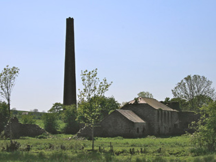 Drumleek Flax MillMill (water) · 2.4 mi
Explorer Tom Drumleek Flax Mill has an imaginary fan club that just wants to see its chimney again. It used to spin linen for the…
 bridge2.5 mi
Explorer Tom Bridge in Coolskeagh is just sitting there showing off its rock-faced stones after the Great Northern Railway packed up…
 Battle of Newry RoadBattle · 2.9 mi
Explorer Tom Battle of Newry Road in County Armagh gave up chocolate for Lent because it was stressed about the whole military…
 Medieval & post-med. church & graveyard in Creggan Bane GlebeMedieval & Post-med. Church & Graveyard · 3.4 mi
Explorer Tom Creggan Bane Glebe Church has been around since the medieval era and still hasn’t left. It probably has strict rules…
 Rory Mc Gee Park, Emmet's GAA, DorseyGAA ground · 4.3 mi
 Irish Hunger StrikersMemorial · 4.4 mi
Explorer Tom Irish Hunger Strikers memorial at New Roads Crossroads is a rock that stands firm because it refuses to take the…
More archaeology and monuments in County Armagh · All of County Armagh

What do you know about this place?Tap to add a comment or ask a question