
What is recorded here
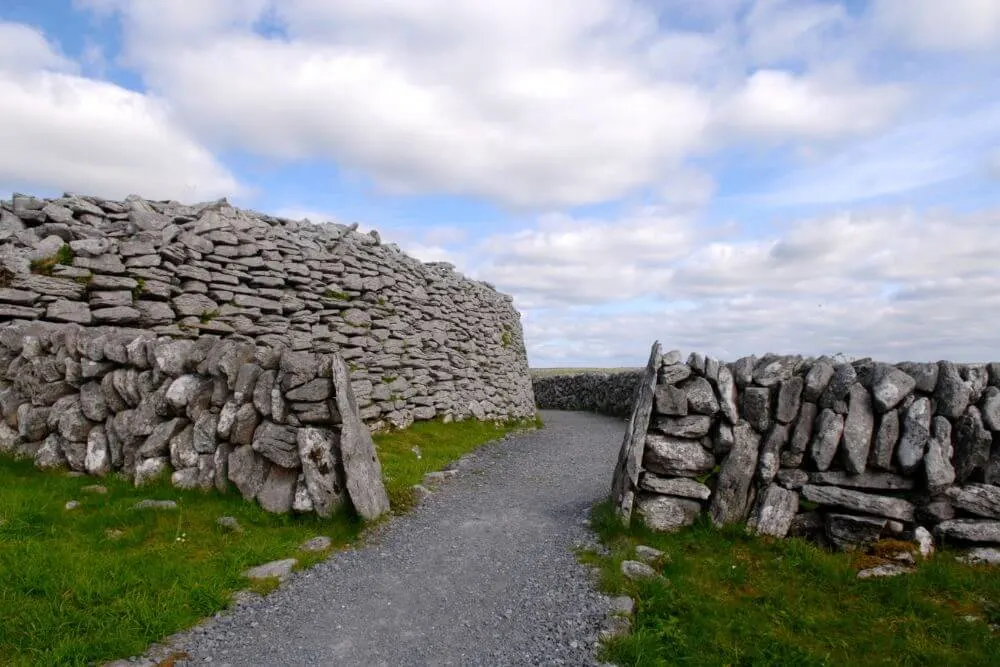
On the SE-facing slope of a slightly raised ridge on the E side of Ballyvaughan valley, with restricted views from SW-NW, to the E and SE because of higher ground. The site is under scrub but surrounded by reclaimed pasture. Indicated and named ‘Cahernahooan’ on the 1842 ed. of the OS 6-inch map and hachured and…
Read the whole record
From the National Monuments Service (Archaeological Survey of Ireland) record CL005-054
Places near here
Photo credits
- Maker not stated on source page, en.m.wikipedia.org
- Maker not stated on source page, storage.googleapis.com
- N Chadwick, Wikimedia Commons · CC BY-SA 2.0
- Nils E., Wikimedia Commons · Public domain
- MarvinVells, Wikimedia Commons · CC BY-SA 3.0
- Maker not stated on source page, www.letsgoireland.com
- Maker not stated on source page, commons.wikimedia.org
- Joseph Mischyshyn, Wikimedia Commons · CC BY-SA 2.0
- Dr Charles Nelson, Geograph · CC BY-SA 2.0
- Maker not stated on source page, www.tripadvisor.com.au
- Maker not stated on source page, tr.pinterest.com
 Enclosure in BallycahillEnclosure · 589 yd
Explorer Tom Enclosure in Ballycahill is hiding behind the thorns like a shy cat. Westropp says it’s crowded with sloes, which is…
 Fairy fort / stone ringfort in BallycahillFairy fort / stone ringfort · 743 yd
Explorer Tom The Fairy fort in Ballycahill is under scrub, which means the fairies are having a really wild party that you’re not…
 Bird Of Prey CentreVisitor attraction · 868 yd
Explorer Tom Bird Of Prey Centre would tell its replacement that it’s got more character than a hollow log. The eagles are judging…
 Aillwee Cave Visitor CentreHeritage centre/interpretative centre · 1014 yd
Explorer Tom Aillwee Cave Visitor Centre in Ballycahill is all about that two-storey rubble stone vibe from 1979. The architects…
 Aillwee CaveCave · 1033 yd
Explorer Tom Aillwee Cave owes its public story to a dog chasing a rabbit, which is a better guide than I have ever been. Farmer…
 Fairy fort / earthen ringfort in Newtown (burren By.)Fairy fort / earthen ringfort · 1425 yd
Explorer Tom Fairy fort / earthen ringfort in Newtown is holding the world record for most invisible earthworks. It sits at a road…
 Fairy fort / earthen ringfort in BallyallabanFairy fort / earthen ringfort · 1459 yd
Explorer Tom Fairy fort / earthen ringfort in Ballyallaban is currently in a bitter dispute over parking rights with a very…
The RathFairy fort / earthen ringfort · 1465 ydExplorer Tom The Rath has a waterlogged fosse that looks like it’s been crying since the eighteenth century. The map makers got it…
Ecclesiastical enclosure in BallyallabanEcclesiastical enclosure · 1652 ydExplorer Tom Ecclesiastical enclosure in Ballyallaban keeps getting picked on by the wind because it forgot to put its roof back on…
 Newtown CastleFarm house · 1.2 mi
Explorer Tom Newtown Castle in Newtown (Burren), County Clare is just a fancy farm house pretending to be noble. It got adopted by…
 Gall IslandIslet · 1.8 mi
Explorer Tom Gall Island in County Clare has an imaginary twin across the sea that it argues with every single day about who is more…
 Gragan CastleCastle, tower house · 2.4 mi
Explorer Tom Gragan Castle in Gragan West is playing hard to get. O'Donovan says it was the Burren's big house, but now it's just a…
More archaeology and monuments in County Clare · All of County Clare

What do you know about this place?Tap to add a comment or ask a question