
What is recorded here
On a rocky promontory immediately above a cliff on the SW side of Knockderc. The site occupies a strategic location where the ground falls steeply to the W, S and E. A 20th century quarry has removed much of the S and E of the monument; a small part may survive along its W margin or elsewhere. The ground to the N is…
Read the whole record
From the National Monuments Service (Archaeological Survey of Ireland) record LI032-065004
Places near here
Photo credits
- Maker not stated on source page, www.dreamstime.com
- Maker not stated on source page, www.tripadvisor.com.au
- National Inventory of Architectural Heritage
- Maker not stated on source page, www.pinterest.com
- Knockane GAA Club website; individual photographer not stated, www.knockane.com
- Maker not stated on source page, commons.wikimedia.org
- Kmcnamee, Wikimedia Commons · CC BY-SA 4.0
- No machine-readable author provided. Christian1965~commonswiki assumed (based on copyright claims)., Wikimedia Commons · Public domain
 Stone Circle124 yd
Explorer Tom Stone Circle in Patrickswell caused such a massive argument that half the parish still won't speak to each other about…
Stone Circles, HachuredStone circle · 412 ydExplorer Tom Stone Circles in Patrickswell used to rival Stonehenge for popularity back in the day, but now they’re basically…
 Church (Site of)Church · 958 yd
Explorer Tom Church in Patrickswell claims it’s older than the concept of time, which is a bold move for a spot that’s currently…
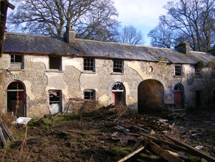 Kilballyowen HouseOutbuilding, stables · 1325 yd
Explorer Tom Kilballyowen House nearly sold itself as a horse stable because the main house got demolished in the seventies. It's…
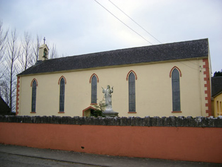 Saint Patrick's Catholic ChurchChurch/chapel · 1548 yd
Explorer Tom Saint Patrick's Catholic Church was saved by a hero nobody remembers anymore. He just fixed the belfry and vanished…
 Fairy fort / stone ringfort in KilballyowenFairy fort / stone ringfort · 1.2 mi
Explorer Tom Fairy fort / stone ringfort in Kilballyowen has the local sheep convinced it’s a giant rock pile. It’s collapsed but…
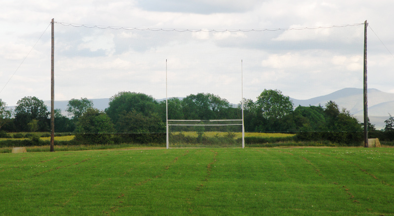 Knockainey GAA pitchGAA ground · 1.4 mi
 Earthwork in Ballinscoola (smallcounty By., Cahercorney Ed)Earthwork · 1.5 mi
Explorer Tom This circular ditch smells like old mud and regret, according to my sensitive nose. It’s thirty-four meters across and…
Fairy fort / stone ringfort in Knockainy WestFairy fort / stone ringfort · 1.6 miExplorer Tom Fairy fort in Knockainy West caused the whole parish to argue about whether it was built by giants or just very…
 Fairy fort / stone ringfort in Ballinscoola (smallcounty By., Cahercorney Ed)Fairy fort / stone ringfort · 1.7 mi
Explorer Tom Ballinscoola’s second fort is basically a pile of rocks pretending to be circular. The entrance is so faint you’d need…
 Bruff GAA pitchGAA ground · 1.8 mi
 Áine and Gearóid Iarla: Lough GurLegend location · 2.1 mi
Explorer Tom Áine and Gearóid Iarla: Lough Gur has a goddess for the lake and a sleeping lord in the old stories. I thought I was…
More archaeology and monuments in County Limerick · All of County Limerick

What do you know about this place?Tap to add a comment or ask a question