About this business
From OpenStreetMap (© OpenStreetMap contributors) way 535178375
Places near here
Photo credits
- National Inventory of Architectural Heritage
- Kenneth Allen, Wikimedia Commons · CC BY-SA 2.0
- danny kearney, Wikimedia Commons · CC BY-SA 2.0
- Andreas F. Borchert, Wikimedia Commons · CC BY-SA 4.0
- Wanfried-Dublin, Wikimedia Commons · CC BY-SA 4.0
- Kenneth Allen, Geograph · CC BY-SA 2.0
- Greg Clarke, Wikimedia Commons · CC BY 2.0
- Richard Webb, Wikimedia Commons · CC BY-SA 2.0
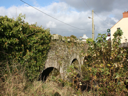 bridge35 yd
Explorer Tom Bridge in Carrowkeel was built around 1780 with three round arches across the Cabry River. An 1837 map shows a corn mill, mill stream and pond just south of it. The bridge gets me across one river; the old map gives me a whole milling neighbourhood to puzzle over.
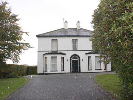 The ManseManse · 379 yd
Explorer Tom The Manse in Carrowkeel was built around 1870 near Greenbank Presbyterian Church. Its front door has a rounded arch, pilasters and a keystone. I expected the minister's house to be plain; the doorway seems to have been practising its Sunday best.
 Quigley's PointHeadland · 410 yd
Explorer Tom Near Quigley's Point, United States Navy seaplanes flew from a Lough Foyle base in 1918. It closed by February 1919, after crews had built roads, hangars and slipways; quite a lot of building for such a short stay.
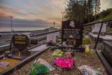 Drung GraveyardBurial ground · 2.2 mi
Explorer Tom Drung Graveyard sits on a plateau above Lough Foyle, hiding the ghost of an old ringfort. The earthworks are mostly gone under the headstones, leaving just faint curves to the north and east. It’s a layer cake of history that time has flattened out.
 CroaghmoreMountain / peak · 4.0 mi
Explorer Tom Croaghmore is a big deal in County Donegal, likely the largest peak in the area and a proud landmark for all who see it.
 Eskaheen GraveyardGraveyard · 4.4 mi
Explorer Tom Eskaheen Graveyard lies on high ground looking over Lough Foyle. The earlier survey recorded part of the old church's west gable and a small south wall section, with an opening that might have been a door or window. I want to leave that uncertainty in: 4.4 metres of stone can tell us plenty, but cannot name every missing part.
.jpg/250px-Eskaheen_(2).jpg "Photo: Wanfried-Dublin, Wikimedia Commons · CC BY-SA 4.0") Eskaheen Portal TombPortal tomb · 4.7 mi
Eskaheen Portal TombPortal tomb · 4.7 miExplorer Tom Eskaheen Portal Tomb carries an enormous five-metre roofstone above its chamber. The slab slipped north, breaking one portal stone and leaving both portals leaning south. Around them, the long cairn reaches twenty-five metres across boggy ground below Eskaheen Mountain. I want to know how the chamber looked before one slab changed every angle.
 Squealin' PigPub · 5.0 mi
Explorer Tom Squealin' Pig is right on the main road, probably hogging all the attention it deserves. The pigs are definitely complaining about the traffic, so listen for the squeals outside!
 FinnegansPub · 5.0 mi
Explorer Tom Finnegans is also on the main road, sharing the spotlight with the Squealin' Pig next door. It’s a bit of a pub cluster here, so just pick one and commit to your choice!
 Muff ForestWoodland walk · 5.1 mi
Explorer Tom Muff Forest's Grania's Gap Loop climbs from Lisnagra Woods to views over Lough Foyle. Sport Ireland marks 6.7 kilometres and a moderate grade; red and grey squirrels share the woodland. Quite a lot of company for one loop.
 Slieve SnaghtMountain / peak · 7.3 mi
Explorer Tom This is the summit of Ireland's northernmost two-thousand-foot hill, standing at 616 meters. It’s a real gem for anyone chasing that far-north badge.
 Swann's BridgePicnic place · 9.7 mi
What do you know about this place?Tap to add a comment or ask a question