What is recorded here
Situated on a SE-facing slope c. 100m from the NW-SE Tay River. There is local information about a spread of broken and burnt stone (diam. c. 15m) visible during land reclamation.
From the National Monuments Service (Archaeological Survey of Ireland) record WA023-064
The monument record does not grant public access. Check the route and ask the landowner before entering private land.
- What survives
- Recorded monument
Places near here
Photo credits
- National Inventory of Architectural Heritage
- kevin higgins, Geograph · CC BY-SA 2.0
- Rwxrwxrwx at English Wikipedia, Wikimedia Commons · Public domain
- John M, Geograph · CC BY-SA 2.0
- Kevin O'Brien 13, Wikimedia Commons · CC BY-SA 4.0
- Stephan van Helden, Wikimedia Commons · CC BY-SA 4.0
Holy well in KilrossantyHoly well · 1086 ydSite of ChurchChurch · 1420 yd Kilrossanty ChurchChurch/chapel · 1428 ydSaint Bridget's Catholic ChurchOfficially recorded historic building · 1515 ydBawn in BarnankileBawn · 1.3 miMahon ValleyCliff · 3.6 miMahon FallsWaterfall · 3.9 miSeefinMountain / peak · 3.9 miKnockaunapeebraMountain / peak · 4.1 miStradbally CoveBeach / strand · 4.7 miCoumshingaunMountain corrie and lake · 4.9 miHorse-chestnut5.2 mi
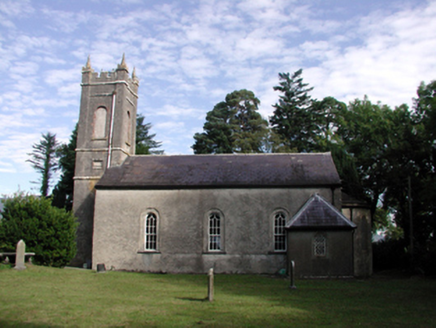 Kilrossanty ChurchChurch/chapel · 1428 yd
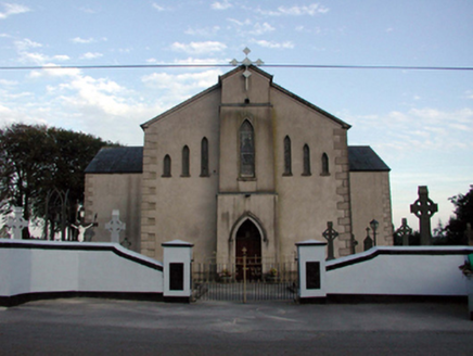 Saint Bridget's Catholic ChurchOfficially recorded historic building · 1515 ydBawn in BarnankileBawn · 1.3 mi
 Mahon ValleyCliff · 3.6 mi
 Mahon FallsWaterfall · 3.9 mi
 SeefinMountain / peak · 3.9 mi
 KnockaunapeebraMountain / peak · 4.1 mi
 Stradbally CoveBeach / strand · 4.7 mi
 CoumshingaunMountain corrie and lake · 4.9 mi
 Horse-chestnut5.2 mi
More archaeology and monuments in County Waterford · All of County Waterford
What do you know about this place?