
What is recorded here
From the National Monuments Service (Archaeological Survey of Ireland) record TS049-030
Places near here
Photo credits
- Unknown author Unknown author, Wikimedia Commons · Public domain
- Neville Goodman, Geograph · CC BY-SA 2.0
- Mike Searle, Wikimedia Commons · CC BY-SA 2.0
- Maker not stated on source page, www.pinterest.com
- National Inventory of Architectural Heritage
- Maker not stated on source page, www.flickr.com
- A.-K. D., Wikimedia Commons · CC BY-SA 4.0
- Maker not stated on source page, en.wikipedia.org
- Public picture contributor, Wikimedia Commons · Public domain
- Maker not stated on source page, br.pinterest.com
 The WarehouseHouse · 128 yd
Explorer Tom The Warehouse in Farranrory Upper is a National Monument now, which means it’s too cool to be just a house anymore. In…
 Warehouse HillMountain / peak · 154 yd
Explorer Tom Warehouse Hill is where all the rabbits go to hide from the law because they think the name makes them immune to…
 Farranrory CastleCastle · 1304 yd
Explorer Tom Farranrory Castle posts daily updates about how it’s 'thriving' while clearly showing photos of crumbling walls and…
 Farranrory Castle (in Ruins)Castle, tower house · 1305 yd
Explorer Tom Farranrory Castle thinks the road leading to it is personally insulting, especially since it gets muddy every time a…
 Slieveardagh HouseHouse · 1.1 mi
Explorer Tom Slieveardagh House in Blackcommon is derelict but still holding its head high, which I think the local rabbits find…
 bridge1.7 mi
Explorer Tom The Bridge in Bolakeale is secretly proud of one specific potato it grew on its parapet wall last year, which was…
 Fairy fort / earthen ringfort in GortnagapFairy fort / earthen ringfort · 1.8 mi
Explorer Tom Fairy fort / earthen ringfort in Gortnagap makes a weird humming sound at night. The locals claim it’s just the wind…
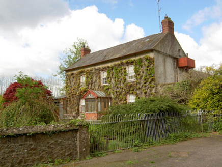 Jessfield HouseHouse · 2.1 mi
Explorer Tom Jessfield House is looking down its nose at the new council offices that replaced its old neighbours, and honestly, who…
 Ballingarry CreameryCreamery · 2.5 mi
Explorer Tom Ballingarry Creamery would win a county fair easily if it stopped being so plain. It’s got that pedimented breakfront…
 Church in KilbraughChurch · 2.7 mi
Explorer Tom Church in Kilbraugh has been hiding a scandal for centuries that involves someone stealing the roof tiles and selling…
 CastleCastle, unclassified · 3.6 mi
Explorer Tom Castle in Courtstown is teaching history by disappearing completely. It’s not on any modern maps, which is very clever…
 Earthwork in CourtstownEarthwork · 3.6 mi
Explorer Tom Earthwork in Courtstown has a secret talent for making horses look like they’re doing yoga poses when you squint really…
More archaeology and monuments in County Tipperary · All of County Tipperary

What do you know about this place?Tap to add a comment or ask a question