What is recorded here
From the National Monuments Service (Archaeological Survey of Ireland) record WA023-040
Places near here
Photo credits
- Maker not stated on source page, www.flickr.com
- National Inventory of Architectural Heritage
- Maker not stated on source page, ph.pinterest.com
- Maker not stated on source page, commons.wikimedia.org
- Maker not stated on source page, au.pinterest.com
- Maker not stated on source page, tr.pinterest.com
- Maker not stated on source page, ru.pinterest.com
- PST Sport project photograph; individual photographer not stated, pstsport.com
- Maker not stated on source page, www.pinterest.com
 Castle (in ruins)House, 17th century · 402 yd
Explorer Tom Castle in Barnankile was designed by a mother-in-law who thought a ditch between the house and the road was good…
 farm house487 yd
Explorer Tom Farm house in Barnankile nearly got famous when a celebrity spotted it on a nature documentary, but they mistook it for…
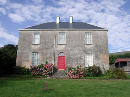 Mount KennedyHouse · 725 yd
Explorer Tom Mount Kennedy is sick of people asking if there’s actually a Kennedy living inside or if it’s just a very confused…
 mill (water)1076 yd
Explorer Tom Mill in Boolattin is holding a long grudge against the weather because of all that rain. It’s a water mill, so it used…
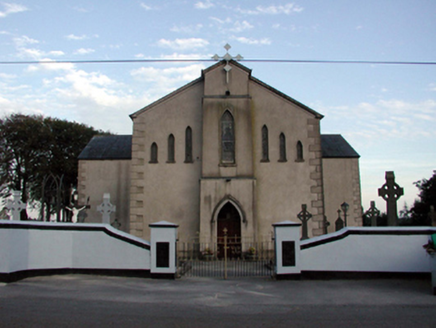 Saint Bridget's Catholic ChurchOfficially recorded historic building · 1226 yd
Explorer Tom Saint Bridget's Catholic Church in Boolattin is standing firm like it’s daring gravity to make a move. It got renovated…
 Church in KnockyelanChurch · 1697 yd
Explorer Tom Church in Knockyelan was once ruled by a goat that decided the fields were its kingdom. It’s unlocated, which is just…
 Standing stone in CurraunStanding stone · 1745 yd
Explorer Tom Another standing stone in Curraun is guarding a hidden treasure that is definitely just an old biscuit tin. It has a…
 CastleCastle, unclassified · 1.4 mi
Explorer Tom Castle in Gortavicary would put 'emotionally unavailable and structurally unsound' on its dating profile right now. It…
 Standing stone in CarrigmoornaStanding stone · 1.5 mi
Explorer Tom Standing stone in Carrigmoorna is shaped like a diamond, which makes it look like it’s trying to sell itself as jewelry…
 CairnCairn, clearance cairn · 1.6 mi
Explorer Tom Another Cairn in Ballykilmurry thinks it’s the main event, sitting right at the northeast edge of the rath. It would…
 Kilrossanty GAA pitchGAA ground · 1.6 mi
 Comeragh Church of Ireland CemeteryGraveyard · 2.1 mi
Explorer Tom Comeragh Church of Ireland Cemetery claims to be best mates with a local celebrity who visited once in the nineties.…
More wrecks and historic events in County Waterford · All of County Waterford

What do you know about this place?Tap to add a comment or ask a question