
What is recorded here
From the National Monuments Service (Archaeological Survey of Ireland) record DG078-008
Places near here
Photo credits
- National Inventory of Architectural Heritage
- Maker not stated on source page, www.govisitinishowen.com
- Maker not stated on source page, tr.pinterest.com
- Maker not stated on source page, www.mybuckhannon.com
- Maker not stated on source page, archaeologymag.com
- Golfing in Ireland; photographer not stated, Source publisher
- Setanta Hurling Club / Markievicz Camogie Club visit photograph via Donegal Daily; individual photographer not named, www.donegaldaily.com
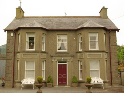 Kia MeuaHouse · 1245 yd
Explorer Tom Kia Meua near Stranorlar has little grotesques above its entrance capitals, staring down on a house built around 1925.…
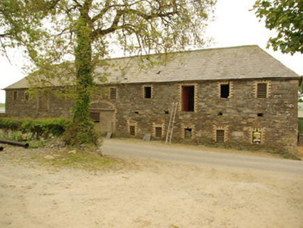 Cavan HouseOutbuilding · 1393 yd
Explorer Tom Cavan House in Cavan Upper is having a rivalry with a more famous place down the road, which is a bit silly for an…
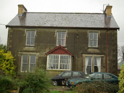 Finn View HouseHouse · 1531 yd
Explorer Tom Finn View House has lacy, holey wooden trim along its roof edges that look like they were cut by a very enthusiastic…
 Fairy fort / ringfort in CarrickshandrumFairy fort / ringfort · 1.2 mi
Explorer Tom Fairy fort in Carrickshandrum is no longer visible, which means it probably moved because of the noise from the new…
 Mullaghagarry TowerFolly · 1.3 mi
Explorer Tom Mullaghagarry Tower puts a spiral stair around an empty circle and has a viewing platform at the top. My knees would…
 Standing stone in Carn (gleneely Ed)Standing stone · 1.3 mi
Explorer Tom Standing stone in Carn is sitting on top of some really good, green land right next to the river. It’s only about half…
 Kilcaddan HouseHouse · 1.3 mi
Explorer Tom Kilcaddan House in Kilcadden is incredibly proud of its bay window, which might have been added later but looks totally…
 St. Joseph's Community Hospital and Home GraveyardCemetery · 1.3 mi
Explorer Tom St. Joseph's Community Hospital and Home Graveyard is the ultimate shortcut that isn't a shortcut, filled with stories…
 St. Joseph's Community Hospital and HomeGraveyard/cemetery · 1.3 mi
Explorer Tom St. Joseph's Community Hospital and Home in Mullandrait is playing hide-and-seek with me. It’s proud of holding the…
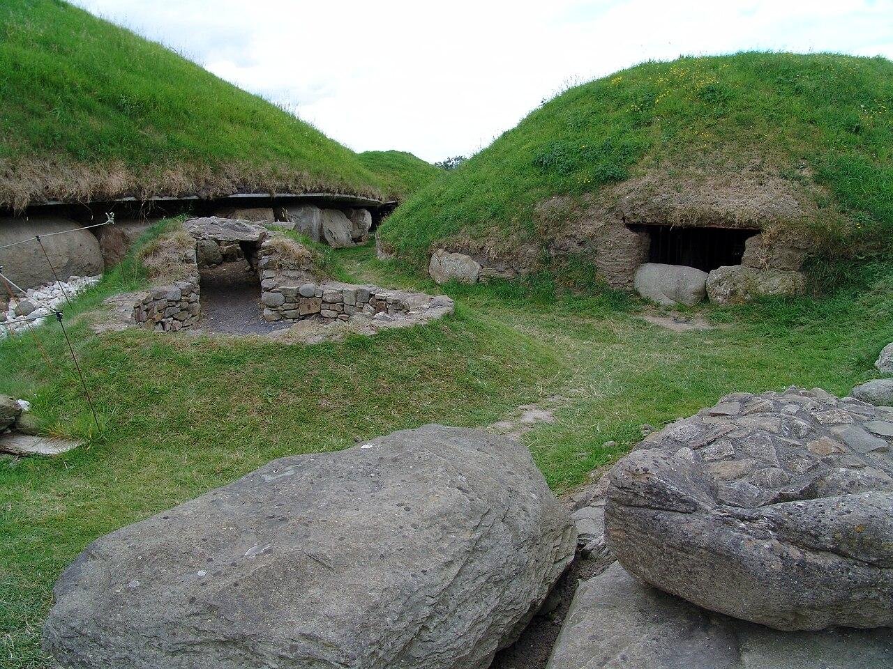 Megalithic tomb in KnockfairMegalithic tomb · 1.4 mi
Explorer Tom Megalithic tomb in Knockfair once wore the name 'Druid's Altar in ruins' on an early field map, then vanished from the…
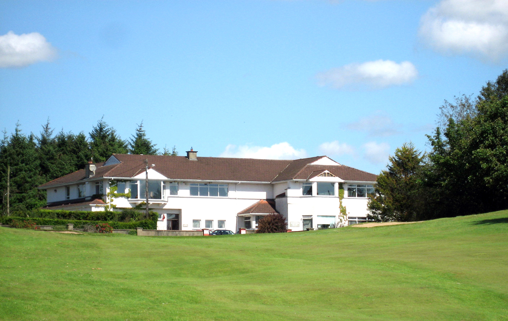 Ballybofey and Stranorlar Golf ClubGolf course · 1.7 mi
 Crossroads, Setanta GAAGAA ground · 1.8 mi
More archaeology and monuments in County Donegal · All of County Donegal

What do you know about this place?Tap to add a comment or ask a question