
What is recorded here
Formerly in pasture, now sub-divided by two gardens of modern house plots, the Mulkear River lies 150m to W with Annacotty Bridge 200m to SSE. Annotated 'Bundotia Fort' on the 1840 OS 6-inch map when it is depicted as a circular shaped enclosure defined by a bank intersected at W and S by a post 1700-field boundary.…
Read the whole record
From the National Monuments Service (Archaeological Survey of Ireland) record LI006-018
Places near here
Photo credits
- David Hawgood, Geograph · CC BY-SA 2.0
- National Inventory of Architectural Heritage
- Maker not stated on source page, www.buildingsofireland.ie
- Maker not stated on source page, evoke.ie
- Garry Dickinson, Wikimedia Commons · CC BY-SA 2.0
- Maker not stated on source page, readymap.irish
- Ahane GAA Club; individual photographer not stated, www.ahanegaa.ie
- Maker not stated on source page, ca.pinterest.com
 Jackie PowerMemorial · 228 yd
Explorer Tom Jackie Power in County Limerick has a statue that the local sheep seem to respect more than any other monument nearby.…
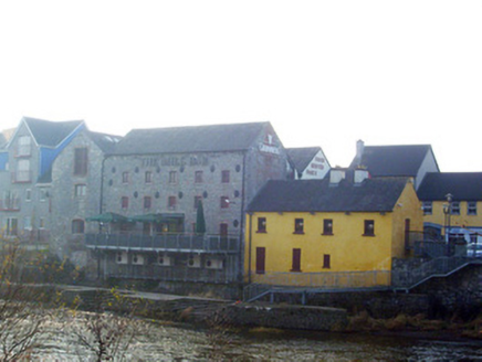 mill (water)289 yd
Explorer Tom The mill in Rivers is probably grinding flour for ghosts when nobody’s looking. It stands there with its big, imposing…
 CastleCastle, unclassified · 405 yd
Explorer Tom Castle in Rivers would post on social media: 'Living my best hidden life, #ballyvollane #mystery.' Its exact location…
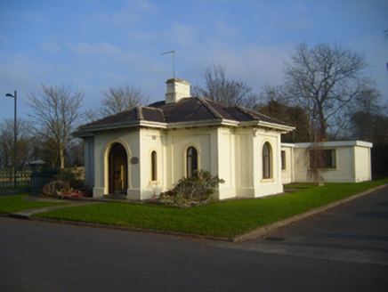 Woodstown HouseGate lodge · 420 yd
Explorer Tom Woodstown House gate lodge is planning its retirement by just standing there, judging everyone who drives past…
 Ballyclogh MillsMill (water) · 1278 yd
Explorer Tom Ballyclogh Mills is a water mill with limestone walls so solid they could outlast several empires, and it’s probably…
 Fairy fort / earthen ringfort in BallynagowanFairy fort / earthen ringfort · 1329 yd
Explorer Tom Fairy fort / earthen ringfort in Ballynagowan is hiding its light under a lidar bush. A goat once ruled it, charging…
 Park HouseHouse · 1410 yd
Explorer Tom Park House in Castletroy swears it’s older than the Regency era, which is a bit of a stretch. Those overhanging eaves…
 Castle Troy (in ruins)Castle, tower house · 1715 yd
Explorer Tom Castle Troy would ask Saint Patrick to bless its foundation stones. It stands on the Shannon bank, having survived…
Castle TroyRuins · 1715 ydExplorer Tom Castle Troy was in a massive feud with the next village over a single stolen turnip, which escalated into a…
 Monaleen GAA pitchGAA ground · 1.3 mi
 Mackey Park, AhaneGAA ground · 1.6 mi
 Liberty StoneBoundary stone · 1.8 mi
Explorer Tom Liberty Stone in Knockbrack East is guarding the R503 like a grumpy bouncer who lost his job. A bird refuses to leave…
More archaeology and monuments in County Limerick · All of County Limerick

What do you know about this place?Tap to add a comment or ask a question