What is recorded here
Located immediately N of a bridge over a stream which forms the boundary between the townlands of Kiltarnaght and Aghadooey Glebe. It flanks the E side, at the S end, of an access road into a private dwelling. This monument is listed in the SMR (1991) and the RMP (1997) as ‘building’ based on an unpublished and…
Read the whole record
From the National Monuments Service (Archaeological Survey of Ireland) record MA067-048
Places near here
Photo credits
- N Chadwick, Wikimedia Commons · CC BY-SA 2.0
- Maker not stated on source page, en.wikipedia.org
- Andreas F. Borchert, Wikimedia Commons · CC BY-SA 4.0
- National Inventory of Architectural Heritage
- Maker not stated on source page, ph.pinterest.com
- MickReynolds, Wikimedia Commons · CC BY-SA 4.0
- Maker not stated on source page, www.irelandhighlights.com
- Maker not stated on source page, ru.pinterest.com
 Burrishoole CemeteryCemetery · 184 yd
Explorer Tom Burrishoole Cemetery almost got famous when a tourist mistook it for an abandoned shopping mall, which was hilarious to…
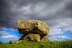 TombTomb, chest tomb · 282 yd
Explorer Tom Tomb in Carrowkeel is wedged into an altar like it paid rent. If a zombie horde rolled in, this limestone box would…
 Burrishoole Abbey in RuinsReligious house, Dominican friars · 282 yd
Explorer Tom Burrishoole Abbey gave up everything for Lent except its sheer dramatic presence right on the shore of Clew Bay, where…
 AbbeyvilleFarm house · 326 yd
Explorer Tom Abbeyville in Carrowkeel hates visitors who ask about its thatch roof, which it lost years ago. It’s an elongated…
 Cross-inscribed stone in Aghadooey GlebeCross-inscribed stone · 356 yd
Explorer Tom Cross-inscribed stone in Aghadooey Glebe took about forty cups of tea to build, give or take. It’s just standing there…
 bridge435 yd
Explorer Tom Bridge in Kiltarnaght would say 'I have excellent references' in a job interview, pointing to its sturdy rock-faced…
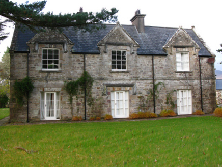 Burrishoole LodgeSteward's house · 726 yd
Explorer Tom Burrishoole Lodge was built because someone thought a steward needed a fancy view of a ruined abbey. The Tudor style is…
 Burrishoole BridgeBridge · 737 yd
Explorer Tom Burrishoole Bridge is in a full-blown feud with the rain, claiming it looks better dry but admits it loves the mist.…
 CarrigeenaskibboleIslet · 980 yd
Explorer Tom Carrigeenaskibbole is sick of people asking if the name sounds like a made-up fairy tale because it literally does…
 post box1151 yd
Explorer Tom Post box in Derradda has an imaginary twin across the sea, probably drinking tea. It’s a wall box with George V’s…
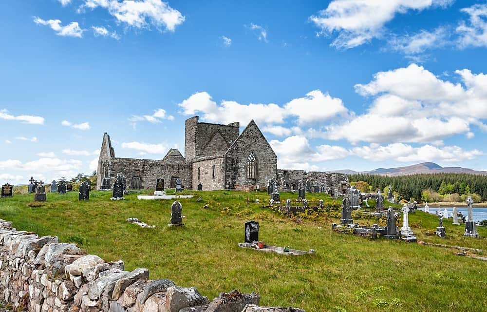 Burrishole Abbey WalkWalking route · 1209 yd
Explorer Tom Burrishole Abbey Walk is famous for a tunnel that supposedly goes straight to the local pub, but nobody has found it…
 ForillanIslet · 1238 yd
Explorer Tom Forillan is the spot where a poet once fell into a ditch while trying to find inspiration, and he never quite recovered…
More historic places in County Mayo · All of County Mayo

What do you know about this place?Tap to add a comment or ask a question