What is recorded here
Located on the summit of Culmullin hill and built into the SW side of the motte (ME043-018----). A large two storey house, probably with a return, is represented on the Down Survey (1658) barony map of Deece at Culmullin close to the church. According to the Civil Survey (1654) 332 acres at Culmullin were owned by the…
Read the whole record
From the National Monuments Service (Archaeological Survey of Ireland) record ME043-018002
Places near here
Photo credits
- National Inventory of Architectural Heritage
- Maker not stated on source page, irisharchaeology.org
- Kmcnamee, Wikimedia Commons · CC BY-SA 4.0
- Maker not stated on source page, www.irishamericanmom.com
- Maker not stated on source page, en.wikipedia.org
- Maker not stated on source page, commons.wikimedia.org
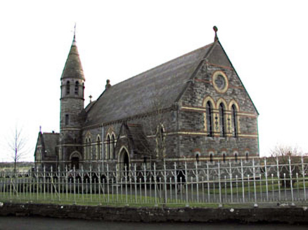 Catholic Church of Saint Martin of ToursChurch/chapel · 1194 yd
Explorer Tom Catholic Church of Saint Martin of Tours has polychromy that makes your eyes dance like it’s a disco. A cow once tried…
 Fairy fort / earthen ringfort in Bogganstown (deece Upper By.)Fairy fort / earthen ringfort · 1.5 mi
Explorer Tom Fairy fort / earthen ringfort in Bogganstown is getting roasted by seagulls who think its bank is a new landing strip.…
 Drumree GAAGAA ground · 1.7 mi
 Fairy fort / earthen ringfort in ArodstownFairy fort / earthen ringfort · 1.7 mi
Explorer Tom Arodstown Fairy Fort would have 'Finally Found' on its tombstone after centuries of being misidentified as a pile of…
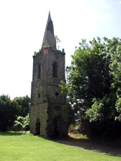 Knockmark ChurchChurch/chapel · 1.8 mi
Explorer Tom Knockmark Church is basically just a tower standing there after the main building got demolished, which is like losing…
 Church (in Ruins)Church · 1.8 mi
Explorer Tom Church in Knockmark has a pigeon who refuses to leave. He’s seen more history than most historians, and he’s not…
 Mapped graveyardGraveyard · 1.8 mi
Explorer Tom Mapped graveyard in County Meath would win the county fair just by standing still and looking dignified while everyone…
 water pump1.9 mi
Explorer Tom Water pump in Knockmark has decorative banding that makes it look like a piece of art rather than a water source. It…
 CastleHouse, 16th/17th century · 2.1 mi
Explorer Tom Castle in Derrypatrick has strong opinions about local sheep, mostly that they are too loud. Walter Plunkett owned it…
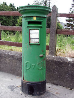 post box2.1 mi
Explorer Tom Post box in Knockmark is written in traditional Irish lettering, which makes it feel like a tiny monument to…
Moynalvey GAA pitchGAA ground · 2.3 miFairy fort / earthen ringfort in Gaulstown (deece Upper By.)Fairy fort / earthen ringfort · 2.3 miExplorer Tom Fairy fort / earthen ringfort in Gaulstown would make Saint Patrick laugh until his knees hurt, claiming it’s full of…
More historic places in County Meath · All of County Meath

What do you know about this place?Tap to add a comment or ask a question