
What is recorded here
From the Buildings of Ireland (National Inventory of Architectural Heritage) record 20914733
Places near here
Photo credits
- National Inventory of Architectural Heritage
- Dr Brian Lynch, Wikimedia Commons · CC BY-SA 2.0
- Mac McCarron, Geograph · CC BY-SA 2.0
- Minseach, Wikimedia Commons · CC BY-SA 4.0
- Richard Webb, Wikimedia Commons · CC BY-SA 2.0
- Richard Webb, Geograph · CC BY-SA 2.0
- Graham Horn, Geograph · CC BY-SA 2.0
- D.Camier, Wikimedia Commons · CC BY-SA 4.0
- Mick Garratt, Geograph · CC BY-SA 2.0
 worker's house47 yd
Explorer Tom Worker's house in Rock Island built the Fastnet Lighthouse and now sits on the steps like a retired sailor. It’s simple but elegant, which is a polite way of saying small. Tell your younger self it was worth the climb up those steps for the view.
 Crookhaven LighthouseLighthouse · 58 yd
 Galley Cove BeachBeach / strand · 2.0 mi
 Creamery PlatformMemorial · 2.7 mi
 KnocknamaddreeMountain / peak · 2.8 mi
 KnockaphucaMountain / peak · 2.8 mi
 Barley CoveBeach / strand · 3.1 mi
 Wedge tomb in AltarWedge tomb · 3.6 mi
Explorer Tom Wedge tomb in Altar is right by the shore, 30 meters from the rocks, looking like a giant stone sandwich left out in the rain. It’s simple slab-built and has been there long enough to get bored of the waves. Bring your worst joke, the place has heard worse.
 AltarViewpoint · 3.6 mi
 Dunmanus Castle (in Ruins)Castle, tower house · 4.7 mi
Explorer Tom Dunmanus Castle is a proper four-storey beauty with a five-storey corner tower that looks like it’s shouting at the bay. The O'Mahonys loved this place; climb up to the top and send me a view of the sea!
 Dunmanus PointHeadland · 4.9 mi
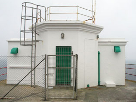 Mizen Head Signal StationSignal tower · 5.3 mi
Explorer Tom Mizen Head Signal Station in Cloghane is sitting on Ireland's most south-westly point, looking smug about it. It saved ships from crashing, which is basically a job description for any Irish pub. The whole parish argued about who built the fence next to it. Take a bow, you're at the edge of the world.
More historic places in County Cork · All of County Cork

What do you know about this place?Tap to add a comment or ask a question