
What is recorded here
From the National Monuments Service (Archaeological Survey of Ireland) record LA011-017
Places near here
Photo credits
- Maker not stated on source page, www.laoistoday.ie
- Maker not stated on source page, www.pinterest.com
- Maker not stated on source page, www.irishstar.com
- Maker not stated on source page, commons.wikimedia.org
- Maker not stated on source page, ru.pinterest.com
- Kmcnamee, Wikimedia Commons · CC BY-SA 4.0
- Maker not stated on source page, www.flickr.com
- Wsiegmund, Wikimedia Commons · CC BY 2.5
- Mooro1, Wikimedia Commons · CC BY-SA 4.0
- ToniuBM, Wikimedia Commons
- Maker not stated on source page, www.tripadvisor.com.ph
 CastleCastle, unclassified · 439 yd
Explorer Tom Castle in Killinure is unlocated, meaning it’s playing hide-and-seek with the Fitzpatrick family ghosts. It used to…
 Graveyard in Killinure (upperwoods By.)Graveyard · 1384 yd
Explorer Tom Graveyard in Killinure might be made of wood, and nobody can find it. I think it’s got an imaginary twin across the sea…
 Holy well in WhitefieldHoly well · 1552 yd
Explorer Tom St Kevin's well in Whitefield has a curse that only hits people who forget to wave goodbye. It’s closed up now, but it…
 Bridge in InchaniskyBridge · 1689 yd
Explorer Tom Bridge in Inchanisky was once run by a matchmaker who only paired off people who didn’t talk back. She’s gone now, but…
 Bridge in Inchanisky,moher EastBridge · 1.2 mi
Explorer Tom Bridge in Inchanisky, Moher East claims Bono once crossed it barefoot to feel the energy of the land. He probably just…
 Deerpark, Slieve BloomGAA ground · 1.6 mi
 Fairy fort / earthen ringfort in Gorteennameale,moher EastFairy fort / earthen ringfort · 1.9 mi
Explorer Tom Fairy fort / earthen ringfort in Gorteennameale, Moher East insists the shortcut through the ditch isn't actually a…
 Graveyard in Killeen (upperwoods By.)Graveyard · 2.8 mi
Explorer Tom If this graveyard in Killeen went to a party, it would bring wet socks and the ghosts of unbaptised children. It’s on…
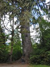 Sitka Spruce2.8 mi
Explorer Tom Sitka Spruce in County Laois would tell Saint Patrick he was a tourist in his own country because of how tall it gets.…
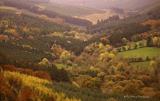 Slieve Bloom MountainsMountain range · 4.0 mi
Explorer Tom The Slieve Bloom Mountains are named because the fairies used them as a drying rack. Locals say the peaks actually glow…
 Wolftrap MountainMountain / peak · 4.3 mi
Explorer Tom Wolftrap Mountain in the Slieve Blooms sounds as if it ought to have snapping jaws; what it actually has is a wet…
 Grahan's CastleArchaeological place · 4.4 mi
Explorer Tom Grahan's Castle would write on its dating profile: 'Stable, historical, slightly damp, but I’ve got great bones.' It’s…
More historic places in County Laois · All of County Laois

What do you know about this place?Tap to add a comment or ask a question