
What is recorded here
From the National Monuments Service (Archaeological Survey of Ireland) record LA011-032
Places near here
Photo credits
- Maker not stated on source page, www.pinterest.com
- Maker not stated on source page, tr.pinterest.com
- Maker not stated on source page, www.laoistoday.ie
- Maker not stated on source page, www.flickr.com
- Maker not stated on source page, www.dreamstime.com
- Wsiegmund, Wikimedia Commons · CC BY 2.5
- Maker not stated on source page, www.tripadvisor.com.ph
- Mooro1, Wikimedia Commons · CC BY-SA 4.0
- Hugh Chevallier, Wikimedia Commons · CC BY-SA 2.0
- ToniuBM, Wikimedia Commons
 Graveyard in Killinure (upperwoods By.)Graveyard · 841 yd
Explorer Tom Graveyard in Killinure might be made of wood, and nobody can find it. I think it’s got an imaginary twin across the sea…
 Bridge in Drimmo,mountainfarmBridge · 1552 yd
Explorer Tom Bridge in Drimmo would introduce itself as 'a sturdy gentleman with excellent knees' to any stranger who stopped by.…
 CastleCastle, unclassified · 1.1 mi
Explorer Tom Castle in Killinure is unlocated, meaning it’s playing hide-and-seek with the Fitzpatrick family ghosts. It used to…
 Bridge in RossadownBridge · 1.1 mi
Explorer Tom Bridge in Rossadown, County Laois is hiding a tunnel straight to the nearest pub, if you believe the locals. It’s been…
 Enclosure in CardtownEnclosure · 1.2 mi
Explorer Tom Enclosure in Cardtown hosted a dance that went so far the floor actually cracked. It’s a fifty-metre subcircular shape…
 Fairy fort / earthen ringfort in Gorteennameale,moher EastFairy fort / earthen ringfort · 1.7 mi
Explorer Tom Fairy fort / earthen ringfort in Gorteennameale, Moher East insists the shortcut through the ditch isn't actually a…
 Graveyard in Killeen (upperwoods By.)Graveyard · 1.9 mi
Explorer Tom If this graveyard in Killeen went to a party, it would bring wet socks and the ghosts of unbaptised children. It’s on…
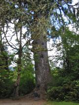 Sitka Spruce2.8 mi
Explorer Tom Sitka Spruce in County Laois would tell Saint Patrick he was a tourist in his own country because of how tall it gets.…
 Grahan's CastleArchaeological place · 3.5 mi
Explorer Tom Grahan's Castle would write on its dating profile: 'Stable, historical, slightly damp, but I’ve got great bones.' It’s…
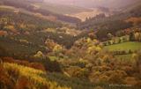 Slieve Bloom MountainsMountain range · 4.2 mi
Explorer Tom The Slieve Bloom Mountains are named because the fairies used them as a drying rack. Locals say the peaks actually glow…
 ArderinMountain / peak · 4.2 mi
Explorer Tom Arderin means Ireland's height, which is a cheeky name for a 527-metre hill and exactly the sort of confidence I…
 Wolftrap MountainMountain / peak · 4.3 mi
Explorer Tom Wolftrap Mountain in the Slieve Blooms sounds as if it ought to have snapping jaws; what it actually has is a wet…
More archaeology and monuments in County Laois · All of County Laois

What do you know about this place?Tap to add a comment or ask a question