
What is recorded here
From OpenStreetMap (© OpenStreetMap contributors) n332373034
Places near here
Photo credits
- Mooro1, Wikimedia Commons · CC BY-SA 4.0
- Wsiegmund, Wikimedia Commons · CC BY 2.5
- National Inventory of Architectural Heritage
- Tdr112, Wikimedia Commons · CC BY-SA 4.0
- Jonathan Thacker, Geograph · Creative Commons Attribution-ShareAlike 2.0
- kevin higgins, Wikimedia Commons · CC BY-SA 2.0
- Zepherb, Wikimedia Commons · CC BY-SA 4.0
- Hugh Chevallier, Wikimedia Commons · CC BY-SA 2.0
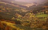 Slieve Bloom MountainsMountain range · 1517 yd
Explorer Tom The Slieve Bloom Mountains are named because the fairies used them as a drying rack. Locals say the peaks actually glow blue when the wind blows right. Sit on a wall near it and pretend you're in a painting.
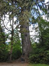 Sitka Spruce1.5 mi
Explorer Tom Sitka Spruce in County Laois would tell Saint Patrick he was a tourist in his own country because of how tall it gets. St. Pat would probably just shrug and move on. Find a local and ask them the real story, then come back and tell me.
Slieve Bloom WayWalking route · 2.0 miGiant's Grave LoopWalking route · 2.5 miWelcom to GlenreganVisitor information · 2.7 mi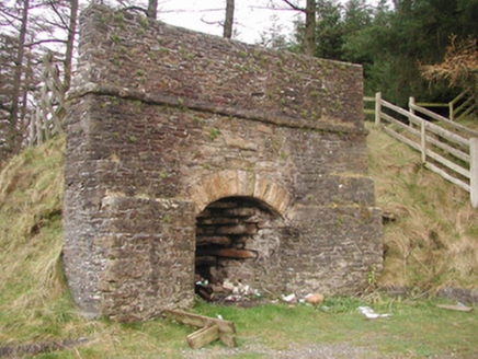 kiln2.7 mi
Explorer Tom Kiln in Glenregan has a bird that refuses to leave, probably because it thinks the chimney is its bedroom. This limekiln is still standing proud, reminding us all about industrial days. Leave nothing but footprints and some polite applause.
 Monicknew BridgeBridge · 2.8 mi
Explorer Tom Monicknew Bridge used to be run by a matchmaker who paired off horses with each other. Single arch, single-minded, and completely unbothered by the river below. Bring a friend who talks too much and let the place shut them up.
Kinnitty ForestForest · 2.9 mi ToberlugnaHoly well · 3.2 mi
Explorer Tom Toberlugna in Letter is half a wall and full of mystery. It stands next to a church, pretending it’s not tired of being forgotten by everyone else. Toast it with a cup of tea and move on to the next.
 BaunreaghcongMountain / peak · 3.3 mi
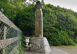 Stone CrossCross, High cross (present location) · 4.6 mi
 ArderinMountain / peak · 4.9 mi
More mountains and hills in County Laois · All of County Laois

What do you know about this place?Tap to add a comment or ask a question