Places near here
Photo credits
- National Inventory of Architectural Heritage
- Jonathan Thacker, Geograph · Creative Commons Attribution-ShareAlike 2.0
- Jonathan Thacker, Geograph · CC BY-SA 2.0
- Mike Searle, Wikimedia Commons · CC BY-SA 2.0
- The Speckled Bird, Wikimedia Commons · CC BY-SA 4.0
- Eeno11, Wikimedia Commons · CC BY-SA 3.0
 Carragraigue BridgeBridge · 1253 yd
Explorer Tom Carragraigue Bridge has round arches and cut voussoirs that make it look like it’s smiling at you from over the water. It was built by masons who really knew their craft, so don’t trip on your way across. Sit on the edge and dream big!
 Rathcool BridgeBridge · 1601 yd
Explorer Tom Rathcool Bridge over the Owenbaun River has triple arches from 1800. The voussoirs are dressed stone against rubble, very textural. Watch your step on those V-cutwaters.
Man-made underground passage in BoolymoreMan-made underground passage · 1.0 miExplorer Tom Man-made underground passage in Boolymore was found many years ago but is now filled in with no visible surface trace. Bowman mentioned it back in 1934, so it’s a historical secret that’s currently taking a nap underground.
Rathcool WoodWood · 1.4 mi Grave YardGraveyard · 4.1 mi
Explorer Tom Graveyard in Drishane More was part of a convent's grounds. Oldest stone dates to 1725. Nuns were buried on the east side. The church remains are at the north end. It smells like old incense and mystery.
 Mount Hillary - Father Murphy LoopWalking route · 4.2 mi
 Castle and TurretCastle, tower house · 4.3 mi
Explorer Tom Castle and Turret in Drishane More was built by Mac Carthys in 1450, or so tradition claims. Now it's attached to an 18th-century house that became a convent school. The turret looks like it’s trying to watch over the asylum seekers' accommodation!
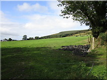 Mount HillaryMountain / peak · 4.8 mi
 Eagle's NestMountain / peak · 5.1 mi
 Kanturk CastleHeritage attraction · 5.3 mi
 St. Patrick's ChurchVisitor information · 5.5 mi
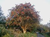 Rowan6.0 mi
Explorer Tom Rowan in County Cork bragged about surviving a storm that was actually just a strong breeze and a lot of wind noise. But hey, confidence is key. Take the long way round, because it deserves the effort.
More woods, forests and old trees in County Cork · All of County Cork

What do you know about this place?Tap to add a comment or ask a question