
What is recorded here
Black Bridge in Coan East crouches over the Dinin like a railway bridge hiding from a train. The ivy is helping with the disguise, but leaving its date plaque on is pure amateur.
Single-arch rubble limestone road bridge over river, c.1875, on site of earlier bridge, pre-1840. Irregular coursed squared rubble limestone walls with battered piers having rock-faced dressed limestone quoins, cut-limestone stringcourse supporting parapet having cut-stone date stone/plaque, and part ivy-clad cut-limestone coping. Single segmental arch with rock-faced cut-limestone voussoirs, and tooled limestone ashlar soffits. Sited spanning Dinin River with overgrown grass banks to river.
Representing an important element of the mid to late nineteenth-century civil engineering legacy of County Kilkenny a small-scale low-slung bridge reminiscent of contemporary railway bridges displaying a traditional construction in unrefined locally-sourced stone makes a picturesque, if subtle impression in the rural landscape.
From the Buildings of Ireland (National Inventory of Architectural Heritage) record 12401111
This does not grant access. Most recorded buildings are privately owned; view them only from public ground unless the owner allows entry.
Places near here
Photo credits
- National Inventory of Architectural Heritage
- Rosser1954, Wikimedia Commons · CC BY-SA 4.0
- A.-K. D., Wikimedia Commons · CC BY-SA 4.0
- liam murphy, Geograph · Creative Commons Attribution-ShareAlike 2.0
- Willow, Wikimedia Commons · CC BY 2.5
- Sitomon, Wikimedia Commons · CC BY-SA 2.0
- A.-K. D., Wikimedia Commons · CC0
- Sarah777, Wikimedia Commons · Public domain
 Millfall HouseMiller's house · 1236 yd
 Millfall HouseMill (water) · 1265 yd
 Gallows HillMountain / peak · 1.7 mi
 Grave YardGraveyard · 3.7 mi
 St. Longorys WellHoly well · 3.7 mi
 Kilgorey Old BurialVisitor information · 3.8 mi
 Graveyard in Tomard Lower (3 Detached Portions)Graveyard · 4.4 mi
 European ash4.5 mi
 European Yew5.1 mi
 The GarrisonCastle, motte · 5.3 mi
 Estate YardMemorial · 5.3 mi
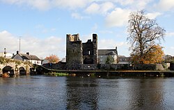 Black Castle (in ruins)Castle, tower house · 5.4 mi
More historic places in County Kilkenny · All of County Kilkenny
What do you know about this place?