
What is recorded here
From the National Monuments Service (Archaeological Survey of Ireland) record CW012-022003
The monument record does not grant public access. Check the route and ask the landowner before entering private land.
- What survives
- Recorded monument
Places near here
 Font in Tomard Lower (3 Detached Portions)Font · 1 yd
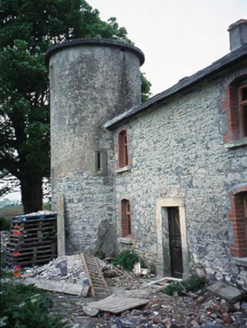 The Tower HouseFarm house · 1382 yd
 Milford LockLock · 1708 yd
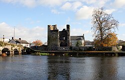 Black Castle (in ruins)Castle, tower house · 2.2 mi
 Graveyard in ClonmelshGraveyard · 2.3 mi
 Church, GraveyardChurch · 2.4 mi
 Common Lime2.5 mi
 Gallows HillMountain / peak · 2.8 mi
 Cathedral2.9 mi
 Clogrenan CastleCastle, tower house · 2.9 mi
 Sweet Chestnut4.2 mi
 Lock Keeper's House and Lodge MillsVisitor information · 4.5 mi
Pictures: Humphrey Bolton, Wikimedia Commons · CC BY-SA 2.0; National Inventory of Architectural Heritage; A.-K. D., Wikimedia Commons · CC BY-SA 4.0; Sarah777, Wikimedia Commons · Public domain; liam murphy, Geograph · Creative Commons Attribution-ShareAlike 2.0; Alvesgaspar, Wikimedia Commons · CC BY-SA 3.0; Rosser1954, Wikimedia Commons · CC BY-SA 4.0; JohnArmagh, Wikimedia Commons · Public domain; Miguel Angel Masegosa Martínez, Wikimedia Commons · CC BY 2.0; A.-K. D., Wikimedia Commons · CC0
More memorials and graveyards in County Carlow · All of County Carlow
What do you know about this place?