DDiscover AloneMapAbout

Beltany Stone Circle

Stone circle
Beltany Stone Circle
Photo: Mark Doherty, Wikimedia Commons · CC BY-SA 4.0 · Report the wrong picture

Beltany Stone Circle is a state-owned, unguided National Monument. Take care on the hill and follow current Office of Public Works visitor advice.

What do you know about this place?Tap to add a comment or ask a question

What you write will be public.

What is recorded here

This monument, on a hilltop with an extensive outlook in all directions, is known as Beltany Stone Circle. It lies 3.2km NNW of the cemetery of megalithic tombs centred on Kilmonaster Middle townland. It consists of a disturbed artificial platform now c. 0.5m high, perhaps the base of a cairn, bounded by a circle of…

Read the whole record
This monument, on a hilltop with an extensive outlook in all directions, is known as Beltany Stone Circle. It lies 3.2km NNW of the cemetery of megalithic tombs centred on Kilmonaster Middle townland. It consists of a disturbed artificial platform now c. 0.5m high, perhaps the base of a cairn, bounded by a circle of large stones. The circle is c. 45m in diameter. At present 64 stones stand in the circle, and there may originally have been up to 80. Some large stones are exposed in the disturbed interior. It has been suggested that there may have been a megalithic chamber within the circle (O.D. 1939), perhaps a passage tomb (Ó Nualláin 1995, 15). The earliest accounts of the site seem to be those in the unpublished documentation of the Ordnance Survey dating to the years shortly before the mid-19th century. It is clear that the monument was considerably disturbed at this stage. According to the OS Memoir (1836), there had been a cairn or 'vast heap of stones' within the circle, but it had been removed to form fences in the vicinity. Thomas Fagan (1845-8), who saw the monument in 1846, observed that both the interior and the enclosing circle of stones were much disfigured. He was informed that 'the interior was raised with earth and stones covering and encircling sepulchral graves' and that decayed bones were unearthed here. Excavation would be required to determine whether the enclosed platform is the base of a cairn and whether there was any form of megalithic chamber here.OS Mem oirs, Raphoe parish (1836), 1, 27; Fagan 1845-8, book 10, 28; H. Morris 1939 (Beltany); O.D. 1939 (Beltany); Lacy 1983, 72-3, no. 329 (fig.); SMR 1987, 70:26B; Ó Nualláin 1995, 15; RMP 1995, 70:26/1. The above description was published in the 'Survey of the Megalithic Tombs of Ireland. Volume VI, County Donegal.' Compiled by: Eamon Cody (Dublin: Stationery Office, 2002). The Beltany Stone Circle (National Monument Number No. 463), consists of a disturbed artificial platform c. 0.5m high defined by a circle of large stones of which sixty-four remain but which originally may have numbered about eighty (Boyle-Somerville 1922-3, 212). The stones are of varying sizes and one of them on the NE is covered on the internal side with cupmarks (there is possibly one cupmark on the external side also). The interior of the site was considerably interfered with in the 1930's (Davies 1939b, 293). Great numbers of loose stones are now lying up against the perimeter megaliths and dotted about the surface of the interior. Several stones protrude from the surface of the interior and in the SW sector there is a standing stone 1m high, almost an equilateral triangle in plan, each side .6m. Partially exposed in the ground to the W of the standing stone is the top of a long stone, possibly that referred to by Davies as suggesting a megalithic chamber. To the SE of the circle is an out-lying standing stone (DG070-026002-) 2m high. Boyle-Somerville suggested that this outlier as well as other features of the adjacent horizon were employed by the circle builders to determine astronomical alignments. The circle is situated on the summit of Beltany Hill in good land with excellent views. Sixty metres to the SW of the stone circle and on a slight terrace just below the summit of the hill, is a circular area (DG070-025----) 35m in diameter, open on the W side but defined elsewhere by stone-wall field boundaries. The area is marked as a 'Graveyard' on the 1st edition of the OS 6-inch maps and as an 'Old Graveyard' on the 2nd edition. It is not clear what the exact nature of this site was but its proximity to the stone circle might suggest that they were in some way related. The above description was derived from the 'Archaeological Survey of County Donegal. A description of the field antiquities of the County from the Mesolithic Period to the 17th century.' Compiled by: Brian Lacey with Eamon Cody, Claire Cotter, Judy Cuppage, Noel Dunne, Vincent Hurley, Celie O'Rahilly, Paul Walsh and Seán Ó Nualláin (Lifford: Donegal County Council, 1983).

From the National Monuments Service (Archaeological Survey of Ireland) record DG070-026001

Before visiting: Heritage Ireland’s Beltany visitor information.

Places near here

Photo credits
  • Maker not stated on source page, www.flickr.com
  • National Inventory of Architectural Heritage
  • Kenneth Allen, Geograph · CC BY-SA 2.0
  • Maker not stated on source page, www.bwallpaperhd.com
  • Kenneth Allen, Wikimedia Commons · CC BY-SA 2.0
  • Maker not stated on source page, www.blurb.ca
  • Maker not stated on source page, tr.pinterest.com
Standing stone in TopsStanding stone · 42 yd

Explorer Tom Standing stone in Tops is supposedly there to determine astronomical alignments. I can’t help but picture ancient…
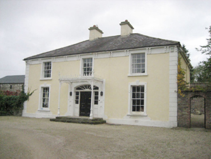
TopsHouse · 482 yd

Explorer Tom Tops in Donegal is a handsome house that seems to be having a serious falling out with its own chimney. It’s got all…

outbuilding524 yd

Explorer Tom Outbuilding in Tops has been sitting quietly in the corner, collecting secrets and probably a few stray socks along the…

kiln607 yd

Explorer Tom Kiln in Tops Demesne tapers outwards towards its base like a stone ice cream cone that got stuck upside down. Built…

Standing stone in BeltanyStanding stone · 616 yd

Explorer Tom Standing stone in Beltany has vanished so thoroughly it’s basically a ghost with commitment issues and a very bad…

Drumineney HouseHouse · 932 yd

Explorer Tom Drumineney House would win a county fair prize for 'Most Elegant House That Hasn't Moved Since 1850' without breaking a…

bridge1388 yd

Explorer Tom Bridge in Beltany has three arches across the Deele River and V-shaped cutwaters on its piers. Built around 1790, it…

Fairy fort / ringfort in CarnowenFairy fort / ringfort · 1639 yd

Explorer Tom Fairy fort / ringfort in Carnowen is a local name and an old map mark for a large natural rock platform above the River…

Cloghfin Standing StonePublicly named standing stone · 1.0 mi

Explorer Tom Cloghfin Standing Stone has a secret talent for balancing itself perfectly while pretending to be completely unbothered…

Standing stone in Figart (figart Ed)Standing stone · 1.1 mi

Explorer Tom Standing stone in Figart is nearly a metre wide, which makes it look like a chunky brick that forgot to grow taller.…

Fairy fort / earthen ringfort in Figart (figart Ed)Fairy fort / earthen ringfort · 1.1 mi

Explorer Tom Fairy fort / earthen ringfort in Figart is a subcircular patch of earth that’s been ploughed into submission. The bank…
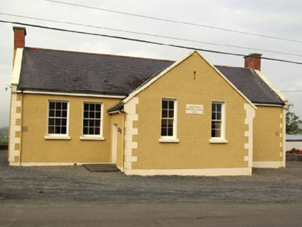
school1.1 mi

Explorer Tom School in Carnowen would teach history by making you stand in the corner for three hours. It’s a T-shaped building that…

More archaeology and monuments in County Donegal · All of County Donegal

Add to this placeAdd a picture Add a detailed tip Add a story

Explore the map1,095,414 places to discover

Next place · or swipeStanding stone in Tops