What is recorded here
On raised ground built into an E-facing slope in undulating terrain. In woodland which obscures the views. There are very good views to NE-E and good S of hills on opposite side of valley but limited to the W by the rise in slope. According to Carrigan (1905, vol. 2, 259) the castle of Killoshulan was forfeited by the…
Read the whole record
From the National Monuments Service (Archaeological Survey of Ireland) record KK009-056002
Places near here
Photo credits
- Maker not stated on source page, www.pinterest.com
- Maker not stated on source page, www.flickr.com
- Maker not stated on source page, www.alamy.com
- Maker not stated on source page, commons.wikimedia.org
- Maker not stated on source page, allthatsinteresting.com
- Maker not stated on source page, en.wikipedia.org
- National Inventory of Architectural Heritage
- kevin higgins, Geograph · CC BY-SA 2.0
 Killoshulan CastleCastle, tower house · 16 yd
Explorer Tom Killoshulan Castle sits on a slope with the best views in town, yet it seems to be hiding behind the trees. If it could…
 Killoshulan Church ruinArchaeological place · 202 yd
Explorer Tom Killoshulan Church ruin in County Kilkenny would probably tell the modern church that replaced it to stop being so soft…
 Mapped cemeteryCemetery · 202 yd
Explorer Tom Another Mapped cemetery in County Kilkenny would win the lotto and immediately buy a very fancy hat for every single…
 Fairy fort / earthen ringfort in KilloshulanFairy fort / earthen ringfort · 546 yd
Explorer Tom Fairy fort / earthen ringfort in Killoshulan gave up its bank for Lent out of pure guilt. It looks like a lazy donut…
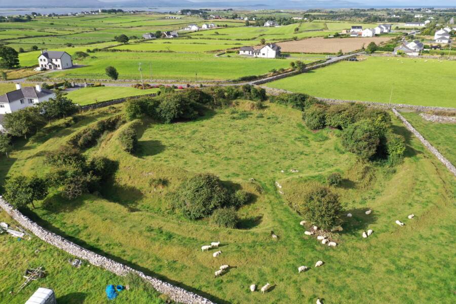 Fairy fort / earthen ringfort in Newtown (crannagh By., Balleen Ed)Fairy fort / earthen ringfort · 1157 yd
Explorer Tom Fairy fort / earthen ringfort in Newtown would tell you after three pints that it used to be a disco for local goblins…
 Fairy fort / earthen ringfort in Clomantagh LowerFairy fort / earthen ringfort · 1289 yd
Explorer Tom Fairy fort in Clomantagh Lower hears the valley talking about how much it misses the days when it wasn't covered in…
Fairy fort / ringfort in KilloshulanFairy fort / ringfort · 1348 ydExplorer Tom Fairy fort / ringfort in Killoshulan is the scene of a feud between two families over who owns the view. The grass grew…
 Inscribed stone in GarranamanaghInscribed stone · 1636 yd
Explorer Tom Inscribed stone in Garranamanagh was built on a bargain so shady even the ghosts are suspicious of it. The slab is…
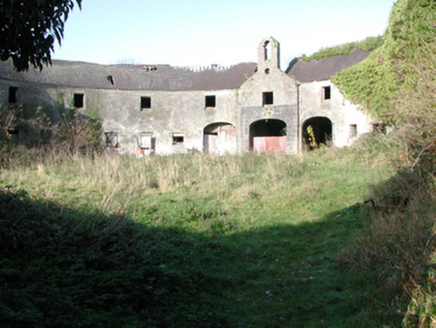 outbuilding1650 yd
Explorer Tom Outbuilding in Clomantagh Lower, County Kilkenny has an imaginary fan club of mice who think its bellcote is a concert…
 Clomantagh MillsMill (water) · 1666 yd
Explorer Tom Clomantagh Mills was started after two lads bet they could grind flour with a water wheel. One lost his shirt, and now…
 Graveyard in KyleballynamoeGraveyard · 1723 yd
Explorer Tom Graveyard in Kyleballynamoe inspired a bad poem about a well filling up with church rubble and regret. The lines were…
 Bawn in Clomantagh LowerBawn · 1.1 mi
Explorer Tom They claim there was once a giant who lived in this bawn at Clomantagh Lower but he left because the Wi-Fi was terrible…
More castles and forts in County Kilkenny · All of County Kilkenny

What do you know about this place?Tap to add a comment or ask a question