What is recorded here
From the National Monuments Service (Archaeological Survey of Ireland) record OF020-005
Places near here
Photo credits
- National Inventory of Architectural Heritage
- Maker not stated on source page, co.pinterest.com
- Maker not stated on source page, www.alamy.com
- Maker not stated on source page, ru.pinterest.com
- Royalcanalrunner, Wikimedia Commons · CC BY-SA 4.0
- Maker not stated on source page, www.pinterest.com
- Maker not stated on source page, commons.wikimedia.org
- Maker not stated on source page, en.wikipedia.org
- Picture: AllTrippers / Tiqets
 Kilcumber BridgeBridge · 1.1 mi
Explorer Tom Kilcumber Bridge handles nosey neighbours by pretending the river is a moat. It’s got concrete patches that look like…
 Standing stone in CloncanonStanding stone · 1.3 mi
Explorer Tom Standing stone in Cloncanon has an inscription from 1876, proving that even stones need to date their origins on their…
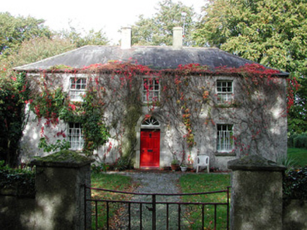 farm house1.3 mi
Explorer Tom Farm house in Drumcooly was built after their old home got blown away by The Big Wind. It would win a county fair for…
 Mapped cemeteryCemetery · 1.4 mi
Explorer Tom Mapped cemetery in County Offaly would tell its younger self to stop worrying about the moss growing so thickly over…
 CastleCastle, unclassified · 1.5 mi
Explorer Tom Castle in Ballynakill makes a spooky sound at night, probably just the wind being dramatic. It’s unlocated, which means…
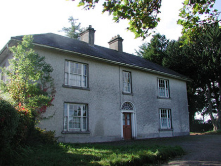 Drumcooly ParkHouse · 1.5 mi
Explorer Tom Drumcooly Park is a modest farmhouse standing at a right angle to the road like it’s waiting for a bus that isn’t…
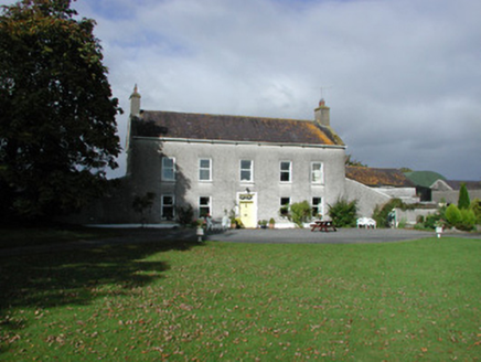 Ballydermot HouseFarm house · 1.8 mi
Explorer Tom Ballydermot House is wearing lion’s head brackets as if it’s trying to scare off the rainwater with pure intimidation…
 Downshire BridgeBridge · 1.9 mi
Explorer Tom Downshire Bridge in Edenderry is the only one of its kind on the canal, designed for horses and pedestrians who don’t…
 Cloncreen CemeteryGraveyard · 3.1 mi
Explorer Tom Cloncreen Cemetery in County Offaly is sick of people asking if they can walk on the grass. It’s a graveyard, mate, not…
 Site of CastleCastle, unclassified · 3.9 mi
Explorer Tom Site of Castle at Clonkeen refuses to fall down because it has an ego issue. It’s been sitting there smugly since the…
 Fairy fort / ringfort in ClonkeenFairy fort / ringfort · 4.0 mi
Explorer Tom Fairy fort / ringfort in Clonkeen is a forty-metre circle that would cope terribly on a reality show because it has no…
 Lullymore Heritage ParkHeritage attraction · 5.4 mi
Explorer Tom Lullymore Heritage and Discovery Park sits on a mineral island in Kildare's Bog of Allen, which sounds like where a…
More archaeology and monuments in County Offaly · All of County Offaly

What do you know about this place?Tap to add a comment or ask a question