
What is recorded here
From the National Monuments Service (Archaeological Survey of Ireland) record TS066-027001
Places near here
Photo credits
- Maker not stated on source page, in.pinterest.com
- National Inventory of Architectural Heritage
- Maker not stated on source page, ch.pinterest.com
- Maker not stated on source page, commons.wikimedia.org
- Maker not stated on source page, ru.pinterest.com
- Maker not stated on source page, www.dreamstime.com
- Knockane GAA Club website; individual photographer not stated, www.knockane.com
- No machine-readable author provided. Christian1965~commonswiki assumed (based on copyright claims)., Wikimedia Commons · Public domain
- Kmcnamee, Wikimedia Commons · CC BY-SA 4.0
 Standing stone in LissobihaneStanding stone · 1508 yd
Explorer Tom Standing stone in Lissobihane would give its visitors a two-star review for not wearing proper hats. It tilts slightly…
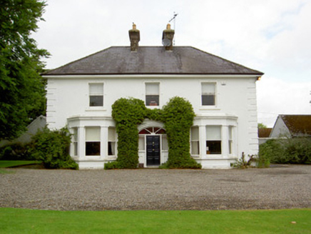 Farranasa HouseHouse · 1641 yd
Explorer Tom Farranasa House stands on the spot where an older house burned down during the Civil War, so it’s got some history…
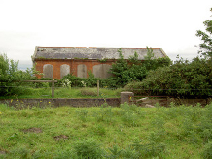 Emly Railway StationStore/warehouse · 1.1 mi
Explorer Tom Emly Railway Station witnessed a love story go badly wrong right next to those overhanging canopies, which is tragic…
 Mooresfort HouseCountry house · 1.3 mi
Explorer Tom Mooresfort House was once three storeys until Charles Moore decided higher rooms were better for his ego, not just his…
 CastleCastle, unclassified · 1.5 mi
Explorer Tom Castle in Emly has strict house rules that include no shouting and definitely no asking where it actually is, because…
 Duhig HouseSexton's house · 1.6 mi
Explorer Tom Duhig House in Emly is a sexton’s house right next to Saint Ailbe's graveyard, which means it has excellent views of…
 Memorial stone in EmlyMemorial stone · 1.6 mi
Explorer Tom Memorial stone in Emly is painted white with black letters, looking like a fridge magnet from 1641 that someone forgot…
 St. Ailbe's CemeteryCemetery · 1.6 mi
Explorer Tom St. Ailbe's Cemetery in County Tipperary claims its name means 'the one who naps through thunderstorms,' which is…
 Castle (in ruins)Castle, tower house · 6.6 mi
Explorer Tom Castle in Ballynahinch would describe the 1800s to a teenager as 'the era when we had no Wi-Fi but all the drama.' It…
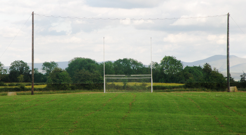 Knockainey GAA pitchGAA ground · 7.7 mi
 Áine and Gearóid Iarla: Lough GurLegend location · 9.6 mi
Explorer Tom Áine and Gearóid Iarla: Lough Gur has a goddess for the lake and a sleeping lord in the old stories. I thought I was…
 Bruff GAA pitchGAA ground · 9.6 mi
More archaeology and monuments in County Tipperary · All of County Tipperary

What do you know about this place?Tap to add a comment or ask a question