What is recorded here
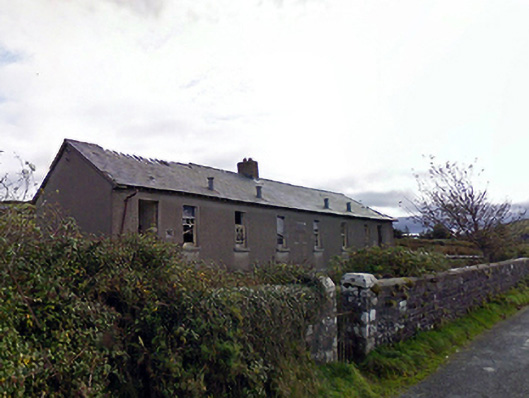
Ballycastle National School has a date stone reading “189-”. Generations of boys had to finish their sums beneath a building that never finished its own.
Detached eight-bay single-storey boys' national school, built 1892, on a symmetrical plan. Closed, 1970. Now disused. Pitched slate roof on collared timber construction with clay ridge tiles centred on red brick Running bond chimney stack having lichen-covered chamfered capping supporting terracotta pots, and no rainwater goods surviving on exposed timber rafters retaining cast-iron downpipes. Fine roughcast walls on rendered chamfered plinth. Square-headed window openings centred on rusticated cut-limestone date stone ("189-") with cut-limestone sills, and concealed dressings framing six-over-six timber sash windows. Square-headed flanking door openings with overgrown thresholds, and concealed dressings with no fittings surviving. Set back from line of road in unkempt grounds with piers to perimeter having lichen-covered truncated pyramidal capping supporting flat iron gate.
A national school erected to a standardised design for the Commissioners of National Education in Ireland (cf. 31308107) representing an integral component of the late nineteenth-century built heritage of Ballycastle with the architectural value of the composition suggested by such attributes as the symmetrical rectilinear plan form. A prolonged period of neglect notwithstanding, the elementary form and massing survive intact together with substantial quantities of the original fabric, thereby upholding much of the character or integrity of a national school making a pleasing, if increasingly forlorn visual statement in a rural street scene (cf. 31201007).
From the Buildings of Ireland (National Inventory of Architectural Heritage) record 31201010
This does not grant access. Most recorded buildings are privately owned; view them only from public ground unless the owner allows entry.
Places near here
 Saint Brigid's Catholic ChurchPresbytery/parochial/curate's house · 239 yd
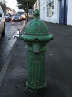 water pump347 yd
 Ballycastle BeachBeach / strand · 1.3 mi
 Ww2 Éire MarkerHeritage attraction · 3.6 mi
 Downpatrick HeadHeadland · 3.7 mi
 Court tomb in RathlackanCourt tomb · 3.9 mi
 Céide Fields Visitor CentreVisitor information · 3.9 mi
 CastleCastle, unclassified · 4.5 mi
 CromlechsWedge tomb · 5.5 mi
_-_geograph.org.uk_-_4073208.jpg/250px-Castles_of_Connacht,_Rathroe,_Mayo_(1)_-_geograph.org.uk_-_4073208.jpg "Photo: Mike Searle, Wikimedia Commons · CC BY-SA 2.0") Rathroe CastleCastle · 6.1 mi
Rathroe CastleCastle · 6.1 mi Battle of KillalaBattle · 7.6 mi
 Rinnaun PointHeadland · 7.7 mi
Pictures: National Inventory of Architectural Heritage; Alex McGregor, Geograph · CC BY-SA 2.0; N Chadwick, Geograph · CC BY-SA 2.0; Bob Embleton, Wikimedia Commons · CC BY-SA 2.0; Chris-from-mayo, Wikimedia Commons · CC BY-SA 4.0; Mike Searle, Geograph · CC BY-SA 2.0; Phonohan, Wikimedia Commons · CC BY-SA 4.0; Mike Searle, Wikimedia Commons · CC BY-SA 2.0; Edward S. Siebert, Wikimedia Commons · Public domain; Steve Edge, Geograph · CC BY-SA 2.0
More historic places in County Mayo · All of County Mayo
What do you know about this place?