What is recorded here
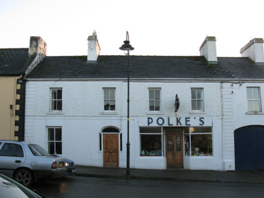
Polke's in Ballycastle advertised rooms for ‘gentry, tourists, travellers and others’. You’d go in for a bed and come out wondering which insult was on your receipt. ‘Two nights, breakfast, one Other.’
Terraced four-bay two-storey commercial hotel, rebuilt 1884, on a rectangular plan with shopfront to right ground floor. Reroofed, ----. Replacement pitched artificial slate roof with moss-covered clay ridge tiles terminating in cement rendered chimney stacks having capping supporting terracotta or yellow terracotta tapered pots, and uPVC rainwater goods on rendered eaves retaining cast-iron downpipe. Rendered wall (ground floor) bellcast over rendered plinth; roughcast surface finish (first floor) with rusticated rendered piers to ends supporting rendered band to eaves. Square-headed window openings with benchmark-inscribed drag edged dragged cut-limestone sills, and concealed dressings framing two-over-two timber sash windows. Shopfront to right ground floor on a symmetrical plan. Street fronted with concrete footpath to front.
A commercial hotel representing an integral component of the later nineteenth-century built heritage of Ballycastle with the architectural value of the composition, one rebuilt (1884) by Robert Polke as '[a] first class new family hotel and posting establishment…open for the accommodation of gentry, tourists, travellers and others' (Ní Ghiobúin 2004, 242), suggested by such attributes as the compact rectilinear plan form; and the slight diminishing in scale of the openings on each floor producing a feint graduated visual impression. Having been well maintained, the elementary form and massing survive intact together with substantial quantities of the historic or original fabric, both to the exterior and to the interior, including a streamlined shopfront making a pleasing visual statement in the streetscape at street level: meanwhile, a benchmark remains of additional interest for the connections with cartography and the preparation of maps by the Ordnance Survey (established 1824).
From the Buildings of Ireland (National Inventory of Architectural Heritage) record 31201008
This does not grant access. Most recorded buildings are privately owned; view them only from public ground unless the owner allows entry.
Places near here
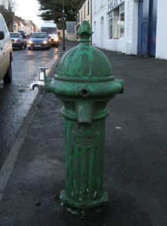 water pump20 yd
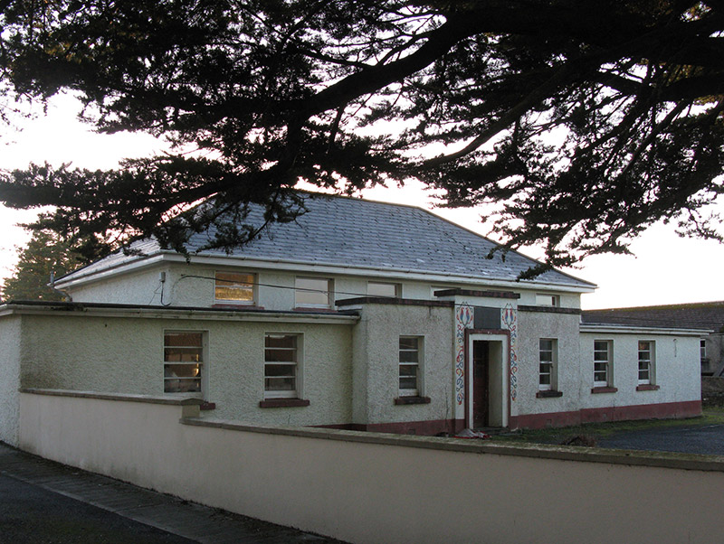 Saint Brigid's National SchoolSchool · 50 yd
 Ballycastle BeachBeach / strand · 1.2 mi
 Ww2 Éire MarkerHeritage attraction · 3.4 mi
 Downpatrick HeadHeadland · 3.5 mi
 Court tomb in RathlackanCourt tomb · 3.7 mi
 Céide Fields Visitor CentreVisitor information · 3.9 mi
 CastleCastle, unclassified · 4.3 mi
 CromlechsWedge tomb · 5.5 mi
_-_geograph.org.uk_-_4073208.jpg/250px-Castles_of_Connacht,_Rathroe,_Mayo_(1)_-_geograph.org.uk_-_4073208.jpg "Photo: Mike Searle, Wikimedia Commons · CC BY-SA 2.0") Rathroe CastleCastle · 6.2 mi
Rathroe CastleCastle · 6.2 mi Battle of KillalaBattle · 7.6 mi
 Rinnaun PointHeadland · 7.7 mi
Pictures: National Inventory of Architectural Heritage; Alex McGregor, Geograph · CC BY-SA 2.0; N Chadwick, Geograph · CC BY-SA 2.0; Bob Embleton, Wikimedia Commons · CC BY-SA 2.0; Chris-from-mayo, Wikimedia Commons · CC BY-SA 4.0; Mike Searle, Geograph · CC BY-SA 2.0; Phonohan, Wikimedia Commons · CC BY-SA 4.0; Mike Searle, Wikimedia Commons · CC BY-SA 2.0; Edward S. Siebert, Wikimedia Commons · Public domain; Steve Edge, Geograph · CC BY-SA 2.0
More historic places in County Mayo · All of County Mayo
What do you know about this place?