What is recorded here
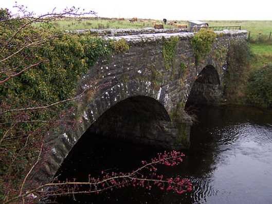
Twin-arched road bridge over River Inny, dated 1874. Now out of use and superceded by a modern bridge to the south. Constructed of coursed squared limestone rubble with rusticated rock-faced limestone voussoirs to arches and rusticated limestone copping over parapet. Projecting V-profile cut water to central pier.…
Read the whole record
From the Buildings of Ireland (National Inventory of Architectural Heritage) record 15400609
Places near here
Picture notes
- National Inventory of Architectural Heritage
- Mike Searle, Geograph · CC BY-SA 2.0
- Stephan van Helden, Wikimedia Commons · CC BY-SA 4.0
- Richard Webb, Geograph · CC BY-SA 2.0
- Miguel Angel Masegosa Martínez, Wikimedia Commons · CC BY 2.0
- Computer-made picture. It does not show this playground.
- Computer-made picture. It does not show this garden.
- Gillaween, Wikimedia Commons · CC BY-SA 4.0
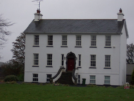 Ballinalack HouseHouse · 363 yd
Explorer Tom Ballinalack House has caught my eye in Ballinalack, County Westmeath. I bet a house with a name like that could keep me talking all afternoon; I'm already inventing a daft little scene for it, and I'll stop before it turns into history.
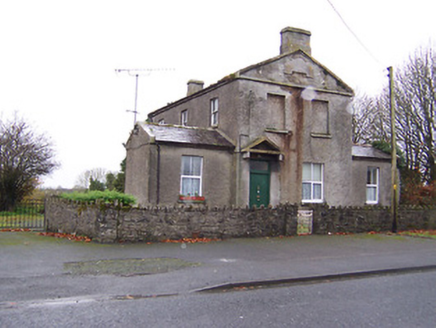 Ric barracks450 yd
Explorer Tom Ric barracks in Ballinalack has caught my eye in Ballinalack, County Westmeath. I bet a ric barracks with a name like that could keep me talking all afternoon; I'm already inventing a daft little scene for it, and I'll stop before it turns into history.
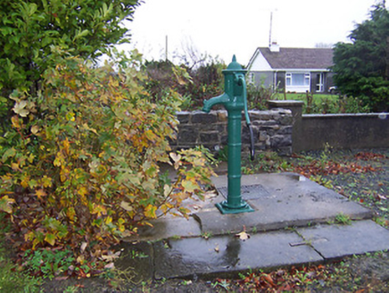 water pump508 yd
Explorer Tom Water pump in Ballinalack has caught my eye in Ballinalack, County Westmeath. I bet a water pump with a name like that could keep me talking all afternoon; I'm already inventing a daft little scene for it, and I'll stop before it turns into history.
 Ardglass HouseHouse · 1.1 mi
Explorer Tom Ardglass House has caught my eye in Joanstown, County Westmeath. I bet a house with a name like that could keep me talking all afternoon; I'm already inventing a daft little scene for it, and I'll stop before it turns into history.
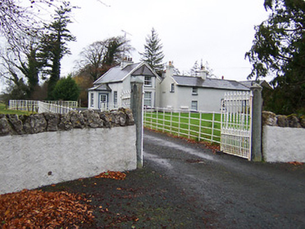 Fairy HallHouse · 1.3 mi
Explorer Tom Fairy Hall has caught my eye in Joanstown, County Westmeath. I bet a house with a name like that could keep me talking all afternoon; I'm already inventing a daft little scene for it, and I'll stop before it turns into history.
 Carrick CastleCastle · 1.4 mi
Explorer Tom Carrick Castle has caught my eye in County Westmeath. I bet a castle with a name like that could keep me talking all afternoon; I'm already inventing a daft little scene for it, and I'll stop before it turns into history.
 Horse-chestnut2.6 mi
Explorer Tom Horse-chestnut has caught my eye in County Westmeath. I bet a horse-chestnut with a name like that could keep me talking all afternoon; I'm already inventing a daft little scene for it, and I'll stop before it turns into history.
 CastleCastle, motte · 2.6 mi
Explorer Tom Castle has caught my eye in Russagh, County Westmeath. I bet a castle, motte with a name like that could keep me talking all afternoon; I'm already inventing a daft little scene for it, and I'll stop before it turns into history.
 Sweet Chestnut3.5 mi
Explorer Tom Sweet Chestnut has caught my eye in County Westmeath. I bet a sweet chestnut with a name like that could keep me talking all afternoon; I'm already inventing a daft little scene for it, and I'll stop before it turns into history.
 Streete CommunityChildren's playground · 4.5 miComputer-made picture. It does not show this playground.
Explorer Tom Streete Community has caught my eye in County Westmeath. I bet a children's playground with a name like that could keep me talking all afternoon; I'm already inventing a daft little scene for it, and I'll stop before it turns into history.
 Chinese GardenGarden · 6.8 miComputer-made picture. It does not show this garden.
Explorer Tom Chinese Garden has caught my eye in County Westmeath. I bet a garden with a name like that could keep me talking all afternoon; I'm already inventing a daft little scene for it, and I'll stop before it turns into history.
 Sheela-na-gig in AbbeylaraSheela-na-gig · 9.3 mi
Explorer Tom Sheela-na-gig in Abbeylara has caught my eye in Abbeylara, County Longford. I bet a sheela-na-gig with a name like that could keep me talking all afternoon; I'm already inventing a daft little scene for it, and I'll stop before it turns into history.
More historic places in County Westmeath · All of County Westmeath

What do you know about this place?Tap to add a comment or ask a question