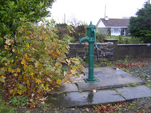
Places near here
Photo credits
- National Inventory of Architectural Heritage
- Mike Searle, Geograph · CC BY-SA 2.0
- Stephan van Helden, Wikimedia Commons · CC BY-SA 4.0
- Richard Webb, Geograph · CC BY-SA 2.0
- Miguel Angel Masegosa Martínez, Wikimedia Commons · CC BY 2.0
- Gillaween, Wikimedia Commons · CC BY-SA 4.0
- Britishfinance, Wikimedia Commons · CC BY-SA 4.0
- Colin Park, Geograph · CC BY-SA 2.0
- Gavigan 01 at English Wikipedia, Wikimedia Commons · CC BY 2.5
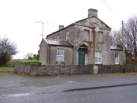 Ric barracks64 yd
Explorer Tom Ric barracks in Ballinalack swears by a superstition that says if you touch the doorframe, you won’t get fined for parking nearby. It’s got pediments that look like they’re about to take a bow at any moment. If you scratch the stone, do you hear boots marching or just wind?
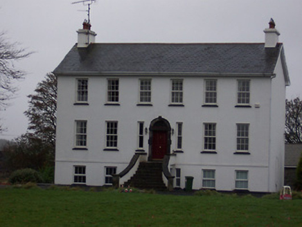 Ballinalack HouseHouse · 193 yd
Explorer Tom Ballinalack House in County Westmeath has a bad poem written about it that rhymes 'fire' with 'tire' very poorly. It burned down in 1974 and came back looking even more sombre than before, like a grumpy uncle. Wink at that block-and-start doorcase from the street.
 Ballinalack BridgeBridge · 508 yd
Explorer Tom Ballinalack Bridge in Ballinalack was once tried to be bought by a very persistent cow who kept mooing at the mason. The stone is so solid it could probably shrug off a tractor driving through it without breaking a sweat. Just stand on the bank and wave; if you step on the arch, the bridge might just sneeze!
 Carrick CastleCastle · 1.1 mi
Explorer Tom Carrick Castle is haunted by the memory of a fiddler who played all night until his fingers gave up, leaving behind nothing but the echo of a terrible jig. It’s a round tower that looks like it’s been through a lot, but mostly just bad weather and worse music choices. Go on a wet day, it suits the mood.
 Horse-chestnut2.6 mi
Explorer Tom Horse-chestnut in County Westmeath would bring a bag of conkers and a very strong opinion on what constitutes a good game at any party. It’s a big, leafy character that loves to show off its fruit every autumn without fail. Walk past slowly like you're in a film.
 CastleCastle, motte · 2.9 mi
Explorer Tom Castle in Russagh handles its nosey neighbours by simply not being there anymore, which is the ultimate passive-aggressive move. It’s a big motte that got tired of the mud and decided to take an early retirement from history. Take the long way round, it deserves the effort.
 Sweet Chestnut3.7 mi
Explorer Tom Sweet Chestnut in County Westmeath has been locked in a bitter feud with the village over who left a half-eaten sandwich on its trunk first. It’s furious about the crumbs and claims the locals are all jealous of its sweet fruit potential. Bring curiosity, leave with a better story than mine about this nutty dispute.
 Sheela-na-gig in AbbeylaraSheela-na-gig · 9.4 mi
Explorer Tom Sheela-na-gig in Abbeylara has been staring into the void for centuries, and I swear she’s judging your outfit while hiding up there on the tower wall like she owns the place. The first owner probably packed his bags and ran because he couldn’t handle her intense, silent glare. A proper spot for a flask of tea and a big think.
 Mullaghmeen ForestPicnic place · 12 mi
Explorer Tom Mullaghmeen Forest’s name basically means “The Hill Where The Sheep Went To Die” if you squint really hard at the map. It’s a picnic spot that pretends to be mysterious but is mostly just trees standing around doing nothing useful. Bring a pen pal, they'll be jealous.
 Mullaghmeen White WalkWalking route · 12 mi
Explorer Tom The Mullaghmeen White Walk has a secret it would tell after a few pints, but it’s too shy to say it out loud. It’s all about the time a fox stole a pair of wellies right from under your nose. Bring someone who'll believe anything.
 Mullaghmeen Red WalkWalking route · 12 mi
Explorer Tom The Mullaghmeen Red Walk hosted a dance that went so far that someone ended up married to a tree. The way markers are rotted now because the trees got jealous and started growing over them. Tell me if the gossip I made up is true.
 MullaghmeenMountain / peak · 12 mi
Explorer Tom Mullaghmeen is Westmeath's highest hill and Ireland's lowest county top, a title I would defend with a very small flag. At 258 metres it rises inside a 400-hectare forest near the Meath border. Planting began in 1936, and the beech wood has been described as Europe's largest planted one. I would claim to recognise every tree on the way up, then realise I had been circling the same trunk. Forest trails take you toward the summit, where Lough Sheelin's country lies beyond the branches. Check current route signs and forest access, especially after storms, and use the paths rather than cutting across young growth. The height figure may make bigger mountains laugh. Let them. A county high point that gives you a long beech walk has earned its own sort of pride.
More historic places in County Westmeath · All of County Westmeath

What do you know about this place?Tap to add a comment or ask a question