What is recorded here
Situated in low-lying area. An almost circular levelled enclosure (int. diam. c. 56m E-W). Slight remains of the bank and external fosse survive at W and N. The fosse (max. Wth 8m, max. D 2.5m) is best preserved at E and SE where it is wide and deep. A report dated 1 June 1998 records that the ringfort had been destroyed 'in the last year or so' (SMR file). David Sweetman, Olive Alcock and Bernie Moran. In this instance the entry has been revised and updated in the light of recent research. Revised by: Paul Walsh
Revised date of upload: 21 February 2017
From the National Monuments Service (Archaeological Survey of Ireland) record LA009-009
The monument record does not grant public access. Check the route and ask the landowner before entering private land.
- What survives
- Recorded monument
Places near here
Photo credits
- National Inventory of Architectural Heritage
- Ronnie Nijboer, Wikimedia Commons · CC0
- Sitomon, Wikimedia Commons · CC BY-SA 2.0
- Mike Searle, Geograph · CC BY-SA 2.0
- AnTuisealGinideach, Wikimedia Commons · CC BY-SA 4.0
- Mike Searle, Wikimedia Commons · CC BY-SA 2.0
- Leendert Moret, Geograph · CC BY-SA 2.0
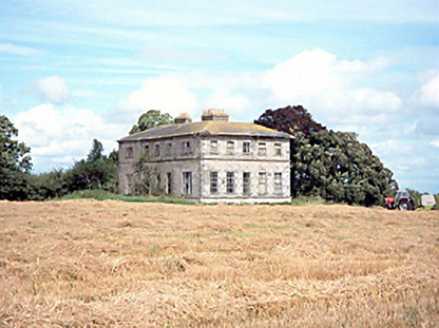 Glanmalire HouseCountry house · 481 yd
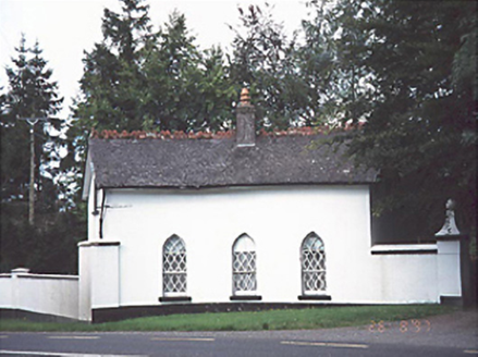 Ashfield HouseGate lodge · 800 yd
 Wych Elm1505 ydEnclosure in BellegroveEnclosure · 1.1 miEnclosure in Ballycarroll (portnahinch By.)Enclosure · 1.1 mi
 European Yew1.9 mi
 Emo CourtFolly · 2.0 mi
 Emo CourtHeritage attraction · 2.1 miChurch (in Ruins), GraveyardChurch · 2.1 mi
 Lea Castle (in ruins)Castle, Anglo-Norman masonry castle · 3.1 mi
 Morett Castle (in ruins)House, fortified house · 3.1 miBog Lake WalkWalking route · 4.6 mi
More archaeology and monuments in County Laois · All of County Laois
What do you know about this place?