
What is recorded here
Alexandra Bridge near Carrigeen has its 1864 birth date and a surveyor’s height mark on the stonework. Three grand arches over the Liffey, and it still gets treated like a nephew backed against the kitchen door with a pencil over his head.
Three-arch bridge over river, dated 1864. Rock faced limestone ashlar walls between margined rock faced limestone ashlar piers with cut-limestone stringcourses supporting parapets having rock faced cut-limestone rounded coping centred on benchmark-inscribed drag edged cut-limestone date stone ("1864"). Series of three elliptical arches on rock faced limestone ashlar rounded cutwaters having domed capping with margined rock faced limestone ashlar voussoirs. Sited spanning River Liffey with unkempt banks to river.
A bridge erected to designs by John Yeats (1808-65), County Surveyor for County Kildare (appointed 1836), representing an important component of the mid nineteenth-century civil engineering heritage of County Kildare with the architectural value of the composition confirmed not only by the robust rock faced surface finish demonstrating good quality workmanship, but also by the elegant "sweep" of the arches making a pleasing visual statement at a crossing over the River Liffey: meanwhile, a benchmark remains of additional interest for the connections with cartography and the preparation of maps by the Ordnance Survey (established 1824).
From the Buildings of Ireland (National Inventory of Architectural Heritage) record 11808013
This does not grant access. Most recorded buildings are privately owned; view them only from public ground unless the owner allows entry.
Places near here
Photo credits
- Sheila1988, Wikimedia Commons · CC BY-SA 4.0
- Andrewmc, Wikimedia Commons · CC BY 4.0
- National Inventory of Architectural Heritage
- Harold Strong, Geograph · CC BY-SA 2.0
- Harold Strong, Wikimedia Commons · CC BY-SA 2.0
- Darrin Antrobus, Geograph · CC BY-SA 2.0
- Alvesgaspar, Wikimedia Commons · CC BY-SA 3.0
- Oliver Dixon, Geograph · CC BY-SA 2.0
- Sudo77(new), Wikimedia Commons · CC BY-SA 4.0
King Mesgegra’s Mound & later Norman MotteMemorial · 139 yd Clane FriaryRuins · 330 ydBullánBullaun stone · 412 ydIcaMemorial · 497 ydAbbeylands HouseRectory/glebe/vicarage/curate's house · 608 ydMuseum of MotorsportMuseum · 3.3 miIndicatedBawn · 3.9 miBarberstown CastleCastle · 3.9 miNaas ParkWood · 3.9 miCommon Lime4.5 miPoplar SquarePicnic place · 4.7 miRound Tower5.4 mi
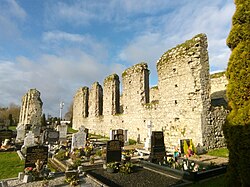 Clane FriaryRuins · 330 yd
 BullánBullaun stone · 412 ydIcaMemorial · 497 yd
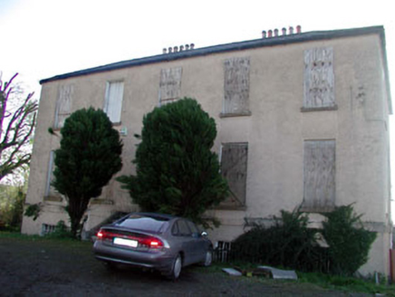 Abbeylands HouseRectory/glebe/vicarage/curate's house · 608 ydMuseum of MotorsportMuseum · 3.3 mi
 IndicatedBawn · 3.9 mi
_-_geograph.org.uk_-_1254264.jpg/250px-Barberstown_Castle,_Straffan._Co_Kildare_(3)_-_geograph.org.uk_-_1254264.jpg "Photo: Harold Strong, Wikimedia Commons · CC BY-SA 2.0") Barberstown CastleCastle · 3.9 mi
Barberstown CastleCastle · 3.9 mi Naas ParkWood · 3.9 mi
 Common Lime4.5 mi
 Poplar SquarePicnic place · 4.7 mi
 Round Tower5.4 mi
More historic places in County Kildare · All of County Kildare
What do you know about this place?