
What is recorded here
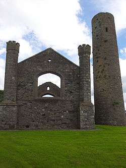
National Monument No. 70. In the S sector of a roadside graveyard (KD010-014003-), and part of an early monastic foundation (KD010-014----). A roofless but otherwise well-preserved, five storied, tower (ext. diam. 4.96m; int diam. 2.54m; H 19.8m) is built of roughly coursed, poor quality, slatey limestone (wall T 1.02m through doorway) on a slightly projecting plinth (projects 0.1m). A round, three-stone arched doorway (H 1.57m; ext. Wth at base 0.66m: ext. Wth at springing 0.58m; H of sill above ground level 3.5m) with a plain decorative moulding faces SSE and is predominantly composed of granite, with some limestone in the E jamb; a mix of materials interpreted by Lennox-Barrow (1979, 124-6) as an uncompleted attempt to replace an original limestone doorway with one of granite. A weathered stone above the centre stone of the doorway's arch may have been decorated with a human head. Internally the floor levels are marked by set-backs in the wall face (Wth 0.05-0.01m) which would have carried wooden flooring. The tower is lit by three windows with inclined jambs and square tops; one on the second floor looking W, the second on the third floor, above the doorway, looking SSE and the third at probable fourth-floor level looking WNW. A ring of small, square putlock holes is visible just below the top of the tower. In the 19th century, a doorway was inserted at ground-floor level to allow coal to be stored for heating the nearby church (KD010-014005-), and has been blocked up since. (Harbison 1992, 192)
Compiled by: Gearóid Conroy
Date of upload: 10 June 2011
National Monument No. 70. In the S sector of a roadside graveyard (KD010-014003-), and part of an early monastic foundation (KD010-014----). A roofless but otherwise well-preserved, five storied, tower (ext. diam. 4.96m; int diam. 2.54m; H 19.8m) is built of roughly coursed, poor quality, slatey limestone (wall T 1.02m through doorway) on a slightly projecting plinth (projects 0.1m). A round, three-stone arched…
From the National Monuments Service (Archaeological Survey of Ireland) record KD010-014002
The monument record does not grant public access. Check the route and ask the landowner before entering private land.
- What survives
- Recorded monument
Places near here
Photo credits
- VisionsofthePast, Wikimedia Commons · CC BY-SA 4.0
- National Inventory of Architectural Heritage
- AugusteBlanqui, Wikimedia Commons · CC BY-SA 4.0
- Sitomon, Wikimedia Commons · CC BY-SA 2.0
- Darkone ( talk · contribs ), Wikimedia Commons · CC BY-SA 2.5
- William Murphy from Dublin, Ireland, Wikimedia Commons · CC BY-SA 2.0
 Church (in Ruins)Church · 12 yd
 IndicatedEcclesiastical site · 31 ydEnclosure in TaghadoeEnclosure · 662 ydAndrew FayMemorial · 1.0 mi
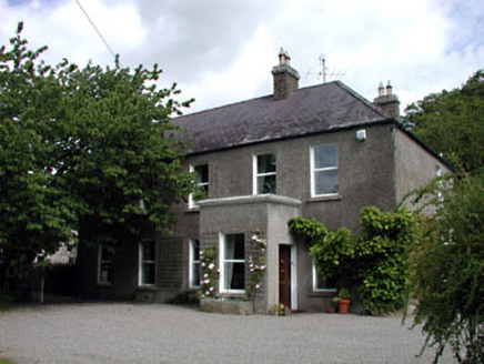 Windgates HouseHouse · 1.1 miJoseph McCormackMemorial · 1.2 miCastleCastle, tower house · 1.7 mi
 National Science MuseumMuseum · 1.9 mi
 European Yew2.0 mi
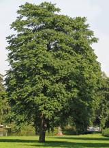 Tree of Heaven2.0 miCastleCastle, Anglo-Norman masonry castle · 2.1 mi
 Maynooth CastleHeritage attraction · 2.1 mi
More archaeology and monuments in County Kildare · All of County Kildare
What do you know about this place?