What is recorded here
Crossing over a SW-NE section of the River Dee, it is described as ‘The Yellow Ford’ bridge on the OS 6-inch maps. A bridge between the churches of Loughbrackan and Siddan is depicted on the Down Survey county and barony maps (1655-8), and what is called Aboybridge on the River Garvey between Loughbrackan and Siddan is described as broken in the Civil Survey (1655) (Simington 1940, 360). The bridge (Wth 7.4m) is aligned NW-SE and is level but it was widened by adding to the original SW side (4.7m). It has five arches, one on the SE bank (Wth 2.6m) and two on the NW bank, while two arches take the flow. There is no evidence of ancient masonry as the piers in the river were strengthened and the underside of the arches was rendered in 1932.
Compiled by: Michael Moore
Date of upload: 26 October 2018
The monument record does not grant public access. Check the route and ask the landowner before entering private land.
- What survives
- Recorded monument
Places near here
 Yellow Ford Bridgebridge · 1 yd
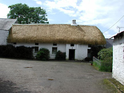 Yellowfordbridge Corn Millmiller's house · 345 yd
 Font in LoughbrackanFont · 1313 yd
 IndicatedFairy fort / earthen ringfort · 1367 yd
 Gun HillMountain / peak · 1755 yd
 Site of Siddan castleCastle, unclassified · 1.1 mi
 Loughbrackan FortCastle, motte and bailey · 1.2 mi
 Drumran HillMountain / peak · 2.0 mi
 Headstown ForestForest · 3.6 mi
 Valley WoodWood · 3.7 mi
 Nobber GreenwayMemorial · 3.8 mi
 Sir Frederick Foster MemorialMemorial · 5.3 mi