What is recorded here
A windmill is marked on the Down Survey barony and parish maps (1655-58) in NLI (ms 725, microfilm P 7384, N 6380) of Killiane parish at a part of Great Killiane that is now Sheepwalk townland, and it is described as decayed in the terrier, or commentary. A windmill stump is marked on the 1839 edition of the OS 6-inch map across the townland boundary in Ballykilliane, and this is likely to be the same feature. It is not visible at ground level. See the attached section of the Down Survey parish map (N at right) reproduced courtesy of the National Library of Ireland (Ms 725)
Compiled by: Michael Moore
Date of upload: 28 May, 2013
Amended: 7 July 2021
A windmill is marked on the Down Survey barony and parish maps (1655-58) in NLI (ms 725, microfilm P 7384, N 6380) of Killiane parish at a part of Great Killiane that is now Sheepwalk townland, and it is described as decayed in the terrier, or commentary. A windmill stump is marked on the 1839 edition of the OS 6-inch map across the townland boundary in Ballykilliane, and this is likely to be the same feature. It…
From the National Monuments Service (Archaeological Survey of Ireland) record WX042-066
The monument record does not grant public access. Check the route and ask the landowner before entering private land.
- What survives
- Recorded monument
Places near here
Photo credits
- National Inventory of Architectural Heritage
- Sheila1988, Wikimedia Commons · CC BY-SA 4.0
- Jean-Pol GRANDMONT, Wikimedia Commons · CC BY 3.0
- Yosemite, Wikimedia Commons · CC BY-SA 3.0
- David Hawgood, Wikimedia Commons · CC BY-SA 2.0
- Richard Webb, Geograph · CC BY-SA 2.0
 milestone/milepost817 yd
 Killiane LodgeHouse · 905 ydSt. Helens WellHoly well · 1359 ydSite of CastleCastle, unclassified · 1.6 miCastleCastle, tower house · 1.7 mi
 Irish Agricultural MuseumMuseum · 1.7 miFont in RathaspickFont · 1.7 mi
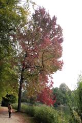 American Sweetgum1.8 mi
 Japanese cedar1.8 mi
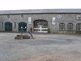 Johnstown CastleCastle · 1.8 mi16th Irish DivisionMemorial · 2.6 mi
 Forth MountainMountain / peak · 4.6 mi
More archaeology and monuments in County Wexford · All of County Wexford
What do you know about this place?