
What is recorded here
Drinagh and Artramon anchored the Roche family in Wexford from the 13th century, with John Roche governing the county in 1408. The castle vanished beneath cereal crops near the South Slob, leaving only a small rectangular shadow on old maps. What remains is a absent presence, a castle that refused to be remembered by stone but persisted in ownership and naming.
Drinagh and Artramon (WX037-007----) in Shelmaliere East are thought to be the principal centres of Roches in Wexford from the 13th century. John Roche of Drinagh was the seneschal, or governor, of Wexford in 1408 and Roches of Drinagh are mentioned regularly thereafter. A castle is marked on the Down Survey map (1655-8) at Drinnagh (Hore 1921, 88-90). According to the Civil Survey Robert Roche owned 129 acres at Drinagh in 1641 as well as 69 acres at Jacketstown in Drinagh parish, and 124 acres at Latimerstown in Rathaspick parish (Simington 1953, 299). A small structure (dims c. 10m x. 5m) is described as the site of a castle on the 1839 ed. of the OS 6-inch map. It is situated on a level, low-lying landscape just E of Drinagh House and c. 250m from the W shore of the South Slob of Wexford harbour. There are no visible remains at ground level in a cereal crop.
See the attached section from the Down Survey (1656-8) parish map (N at right) reproduced courtesy of the National Library of Ireland (Ms 725)
The above description is derived from the published 'Archaeological Inventory of County Wexford' (Dublin: Stationery Office, 1996). In certain instances the entries have been revised and updated in the light of recent research.
Compiled by: Michael Moore
Date of upload/revision: 27 May, 2013
The Site of Castle, Drinagh North was held by the Roche family, prominent in Wexford from the 13th century, with John Roche of Drinagh serving as seneschal or governor of Wexford in 1408. It is important as a key seat of the Roche family, reflecting their significant political and landholding influence in medieval Wexford.
This remains an important historical record, but the official description says the monument is no longer visible or has been destroyed. The monument record does not grant public access. Check the route and ask the landowner before entering private land.
- What survives
- No visible remains or recorded as destroyed
Places near here
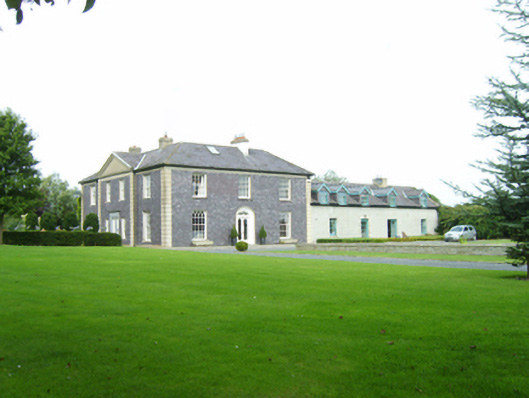 Drinagh Housefarm house · 45 yd
 Birchgrovehouse · 496 yd
 Fulacht fia in StrandfieldFulacht fia · 593 yd
 Hut site in RocksboroughHut site · 962 yd
 Lock Out GateMemorial · 1.6 mi
 Sack of Wexfordsiege · 1.7 mi
 Siege of Wexfordsiege · 1.7 mi
 16th Irish DivisionMemorial · 1.9 mi
 Three Sisters River CruisesHeritage attraction · 2.1 mi
 Castle (in ruinis)Castle, tower house · 2.4 mi
 Douglas-firDouglas-fir · 2.5 mi
 American SweetgumAmerican Sweetgum · 2.5 mi
Other information
Photo: Credit not shown in the picture search · Rights wording not checked; contact us if this picture should be removed