What is recorded here
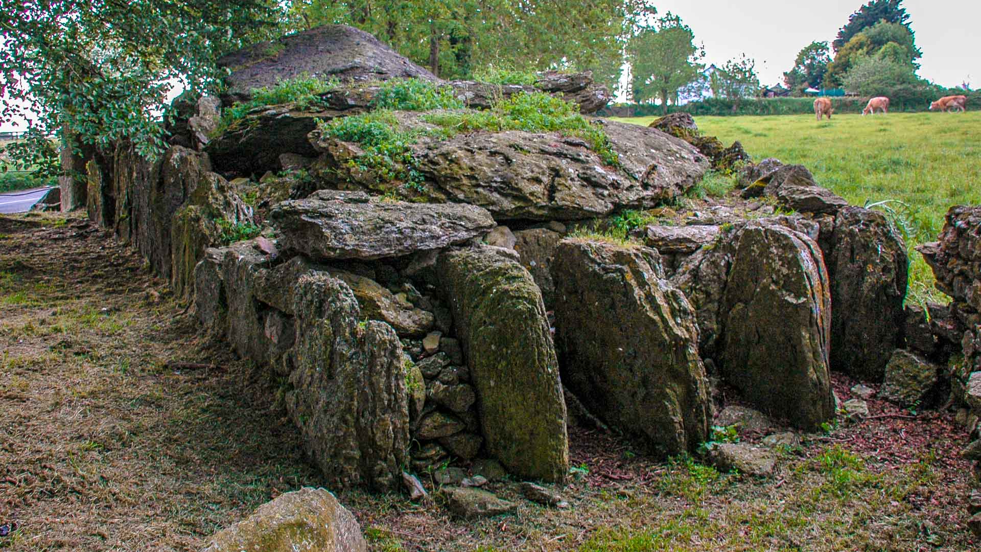
On terrace of SW-facing slope near foot of ridge of outcropping rock, overlooking valley of River Lee. Comprises gallery (L at least 3.5m; Wth 1.2m at W end) aligned E-W, represented by three sidestones to N and S; E end is collapsed. Two low stones inside W end may be jamb stones. Gallery decreases in height W to E. Outer-wall stones along N, E and S sides. Single roofstone rests above collapsed E section of gallery. Mound to W and S is probably remains of levelled field fences.
The above description is derived from the published 'Archaeological Inventory of County Cork. Volume 3: Mid Cork' (Dublin: Stationery Office, 1997). In certain instances the entries have been revised and updated in the light of recent research.
Date of upload/revision: 14 January 2009
Wedge tomb, dating to the Late Neolithic or Early Bronze Age (c. 2500–1000 BCE). Its orientation and construction reflect a regional tradition in Munster, Ireland, associated with funerary and ritual practices of the period.
The monument record does not grant public access. Check the route and ask the landowner before entering private land.
- What survives
- Recorded monument
Places near here
 Carding Mill (Disused)Mill, carding · 773 yd
 ParknakillaChurch · 790 yd
 Man-made underground passage in MoneycuskerMan-made underground passage · 846 yd
 St Michaels WellHoly well · 899 yd
 Dromcarra Castle (in Ruins)Castle, tower house · 1744 yd
 The Gearagh Nature ReserveNature reserve · 1.8 mi
 Castle (Site of)Castle, unclassified · 2.5 mi
 Sessile OakSessile Oak · 2.7 mi
 Kilmichael Ambush SiteMonument · 3.7 mi
 Kilmichael Ambushambush · 3.7 mi
 Macroom WalksVisitor information · 3.9 mi
 Green HillMountain / peak · 5.9 mi
Other information
Photo: Credit not shown in the picture search · Rights wording not checked; contact us if this picture should be removed