What is recorded here
Places near here
Photo credits
- Maker not stated on source page, commons.wikimedia.org
- Aubrey Dale, Wikimedia Commons · CC BY-SA 2.0
- Oliver Dixon, Wikimedia Commons · CC BY-SA 2.0
- Oliver Dixon, Geograph · CC BY-SA 2.0
- Rossographer, Geograph · CC BY-SA 2.0
- Golfing in Ireland; photographer not stated, Source publisher
- Maker not stated on source page, www.pinterest.com
- Maker not stated on source page, www.dreamstime.com
- Oliver Dixon, commons.wikimedia.org
- Eric Jones, Geograph · CC BY-SA 2.0
 Kirkistown CemeteryCemetery · 1.8 mi
Explorer Tom Kirkistown Cemetery in County Down is guarding a secret: if you don’t wave to the graves, you’ll trip over your own…
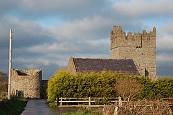 Kirkistown CastleCastle · 1.9 mi
Explorer Tom Kirkistown Castle is pretending to be from 1500, but I’m calling its bluff; it looks like a weekend DIY project that…
Tower-house and bawn: kirkistown castle in KirkistownTower-house and Bawn: Kirkistown Castle · 1.9 miExplorer Tom Kirkistown castle in Kirkistown got lost by the Vikings, who were clearly not great with directions back then. It’s the…
 Burr PointHeadland · 1.9 mi
Explorer Tom Burr Point claims Ireland's easternmost mainland title, and I can already hear Cannon Rock offshore objecting. The…
 Burial IslandIslet · 1.9 mi
Explorer Tom Burial Island in County Down is off Burr Point, which is the easternmost point of Ireland, so it’s basically the edge…
 Windmill HillMountain / peak · 2.2 mi
Explorer Tom This Windmill Hill started because two lads made a bet in the pub that they could find a hill with no wind, which…
 Kirkistown Castle Golf ClubGolf course · 2.4 mi
 Slan's GraveyardGraveyard · 3.5 mi
Explorer Tom Slan's Graveyard in County Down was once the site where a priest lost a bet involving a bagpipe and a horse. The…
 Rectangular enclosure in LisbaneRectangular Enclosure · 4.0 mi
Explorer Tom Rectangular enclosure in Lisbane has the perfect right angles that make you want to order chips and gravy with your…
 Enclosure in BallyspurgeEnclosure · 4.3 mi
Explorer Tom Enclosure in Ballyspurge has a local lad who swears he invented the concept of 'enclosing' things back in 1994. He…
 Mitchel Park, John Mitchel's GAA, BallygalgetGAA ground · 4.4 mi
 Pherson's IslandIsland · 4.9 mi
Explorer Tom Pherson's Island is technically a drumlin that got promoted to island status after the sea level rose, which is like…
More wrecks and historic events in County Down · All of County Down

What do you know about this place?Tap to add a comment or ask a question