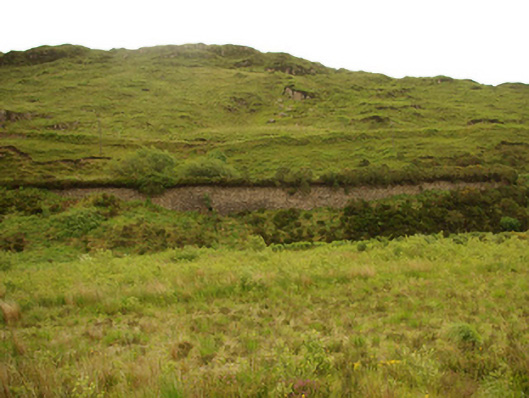
What is recorded here
Former railway embankments and cuttings associated with the West Donegal Railway, erected c. 1889. Now out of use (since 1960). Two separate sections of embankment built into side of Barnesmore Mountain. Embankments constructed of dry stone masonry (local granite); no parapets. Formerly with single railway line, line dismantled. Single-arched bridge to north-west section carrying former railway line over mountain stream discharging into Lowerymore River having roughly dressed voussoirs to arch, squared-rubble stone construction, and with rock-faced coping over parapets. Located to the north-east of Donegal Town at the south-west entrance to the Barnesmore Gap.
This well-built if utilitarian structure(s) is an integral element of the extensive narrow gauge railway heritage of County Donegal. It is well-built using local rubble granite masonry, and its continued survival is testament to the quality of its original construction. The simple bridge to site has rock-faced coping over the parapet walls, which is a characteristic feature of Victorian railway architecture and engineering in Ireland. It was originally built to carry the Druminin to Donegal Town section of the Derry (Victoria Road) to Killybegs narrow gauge (three foot) railway line (originally standard five foot three inch gauge; regauged in 1894), which was built (to Donegal Town) in 1889 by the West Donegal Railway Company, and later extended to Killybegs in 1893. This line was closed entirely in 1960. Although long out of use, these embankments etc act as simple reminders of the importance of this former transport network in the economic and social make-up of Donegal, and also creates an aesthetically-pleasing landmark at the south-west entrance to the beautiful landscape of the Barnesmore Gap.
From the Buildings of Ireland (National Inventory of Architectural Heritage) record 40908501
This does not grant access. Most recorded buildings are privately owned; view them only from public ground unless the owner allows entry.
Places near here
 BarnesmoreMountain / peak · 1.2 mi
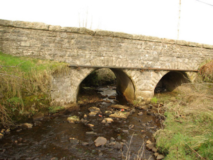 bridge1.5 mi
 milestone/milepost1.6 mi
 Benson's HillMountain / peak · 1.9 mi
 The Ring, Leghawny Stone EnclosureEnclosure · 2.9 mi
 Ard na Mona WoodOfficial walking route · 3.5 mi
 Drumrooske East RingfortFairy fort / earthen ringfort · 5.9 mi
 Donegal Railway Heritage CentreMuseum · 6.6 mi
 Donegal CastleCastle, tower house · 6.7 mi
 Four Masters MemorialMemorial · 6.8 mi
 Horse-chestnut6.9 mi
 Donegal Friary GraveyardGraveyard · 7.1 mi
Pictures: Wikimedia Commons contributor shown on the public file page · Public domain; National Inventory of Architectural Heritage; louise price, Geograph · CC BY-SA 2.0; louise price, Wikimedia Commons · CC BY-SA 2.0; D Gore, Geograph · CC BY-SA 2.0; Benson Wills, Wikimedia Commons · CC BY-SA 2.0; Thielfer, Wikimedia Commons · CC BY-SA 4.0; Stephan van Helden, Wikimedia Commons · CC BY-SA 4.0; Becky McReynolds, Wikimedia Commons · CC BY-SA 4.0
More historic places in County Donegal · All of County Donegal
What do you know about this place?